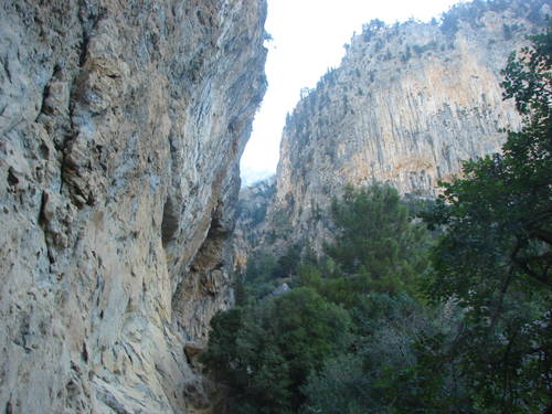
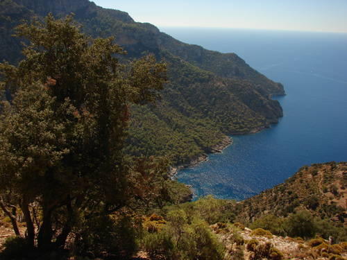
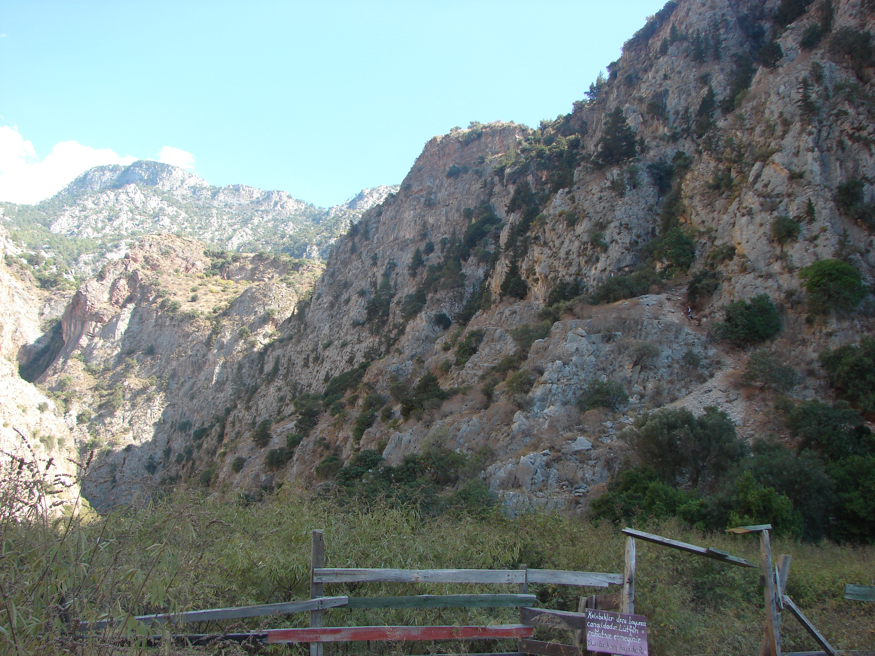
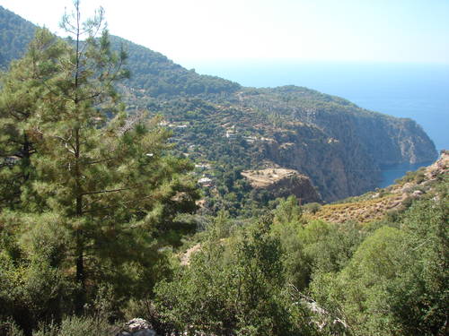
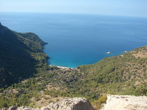
Above_Kabak1.jpg
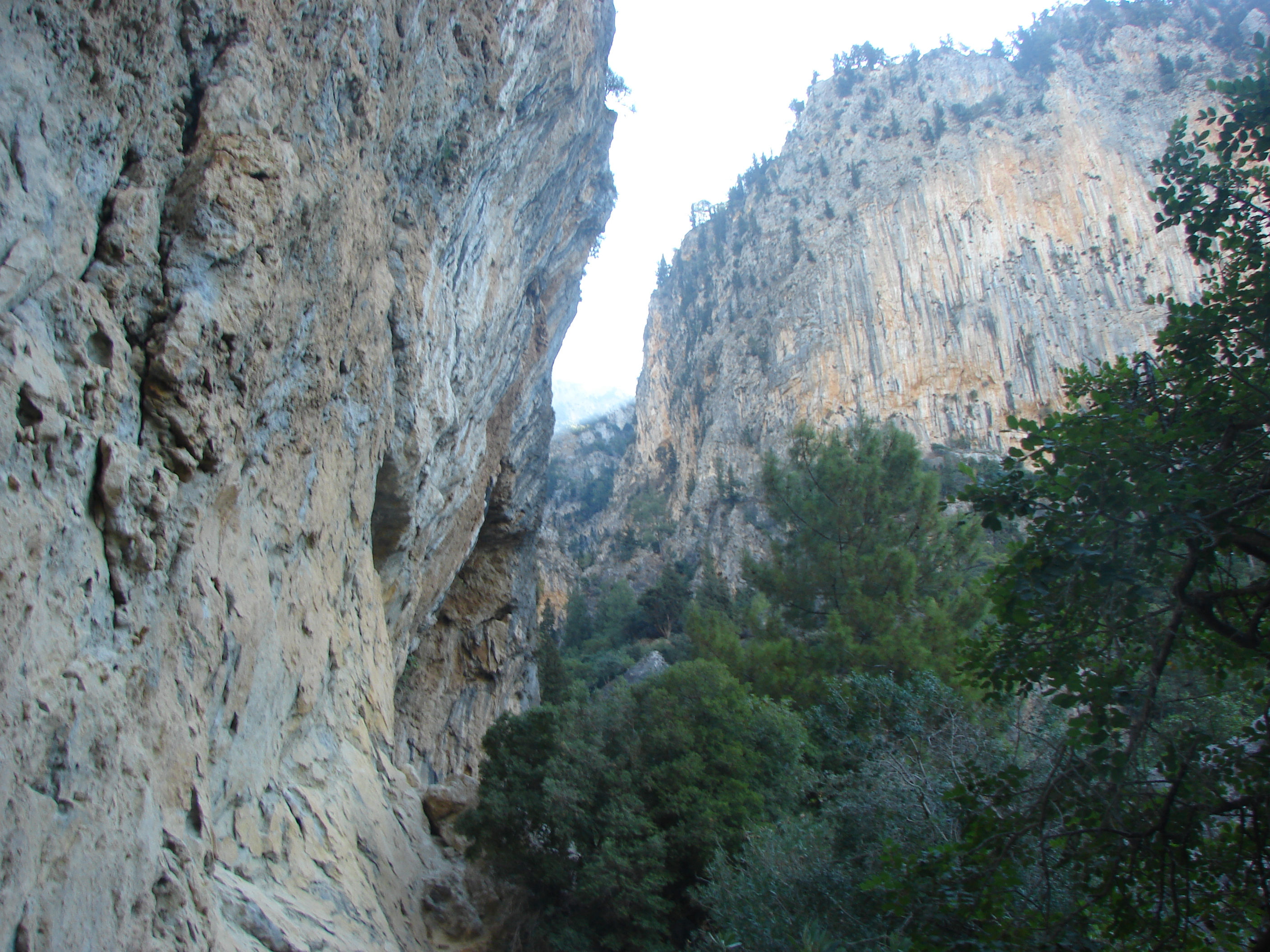
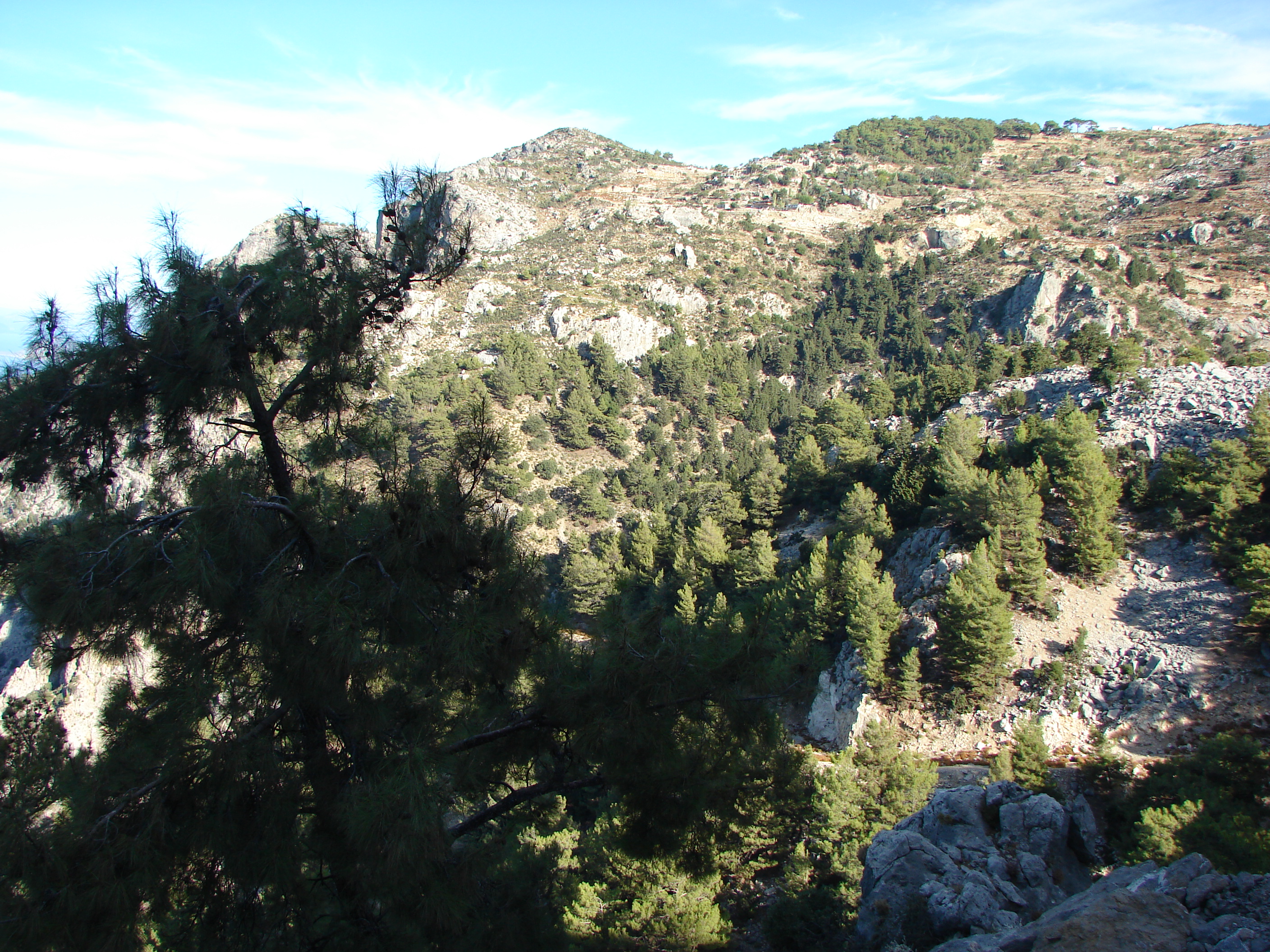
steep cliffs above the narrow path
that contours around the inlet

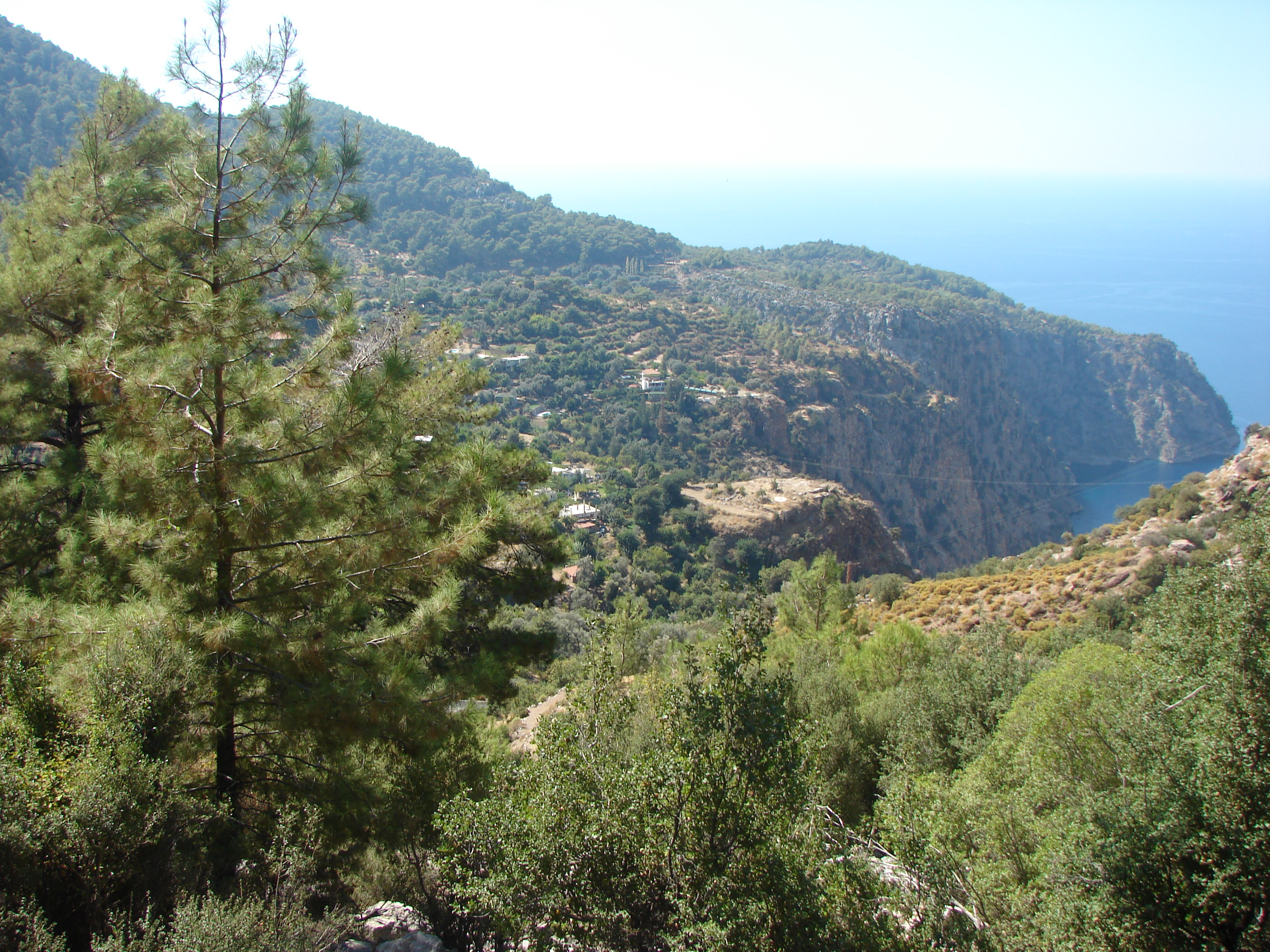
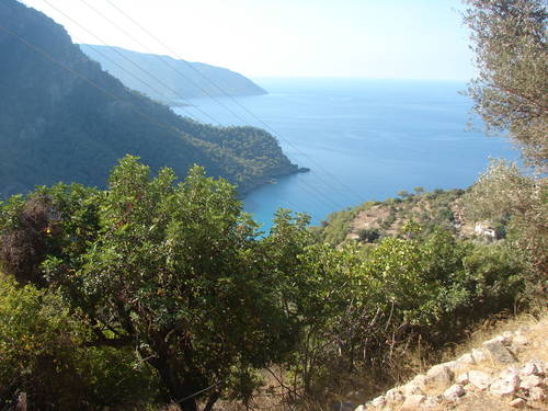
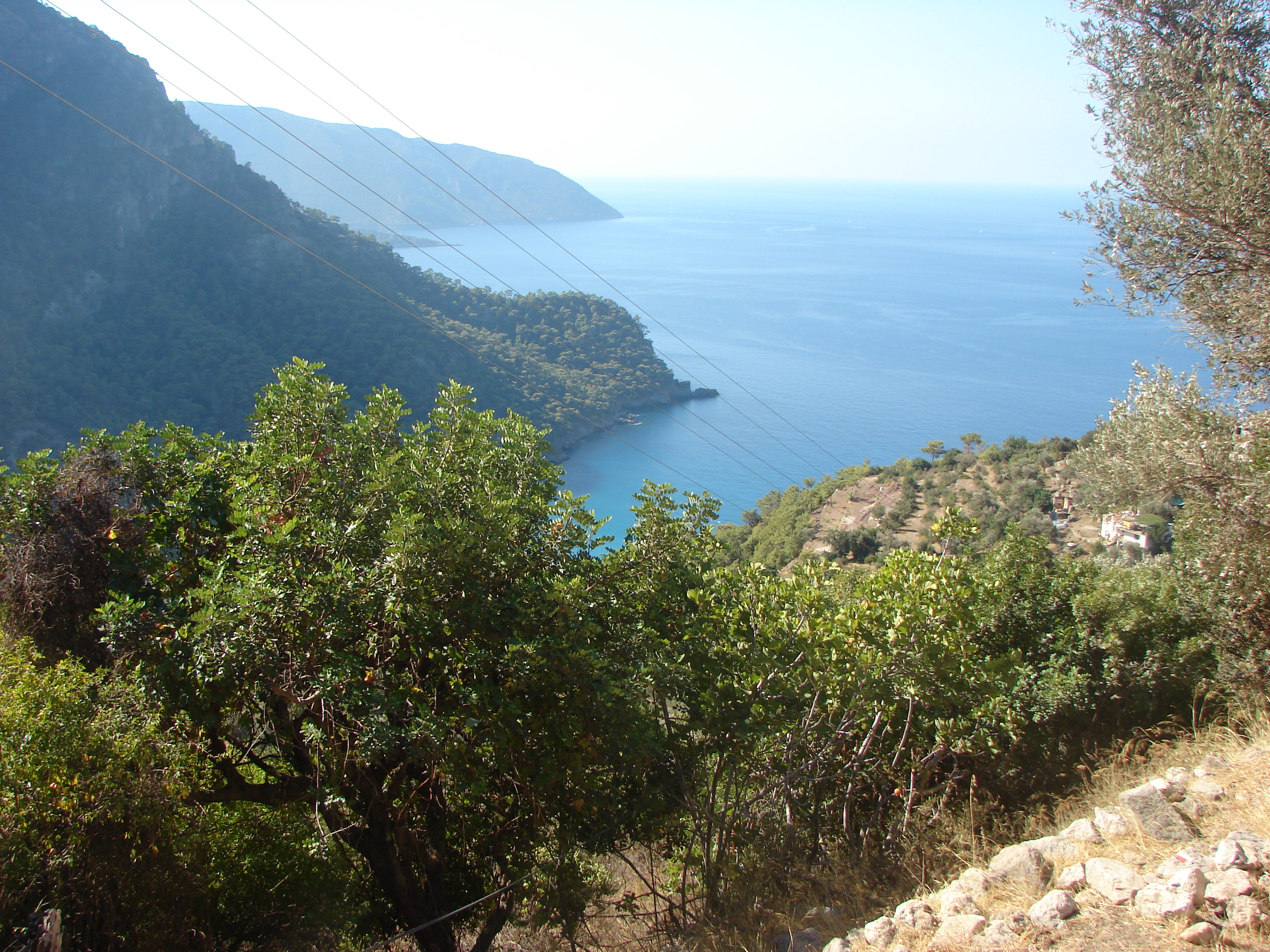
Above_Kabak2.jpg
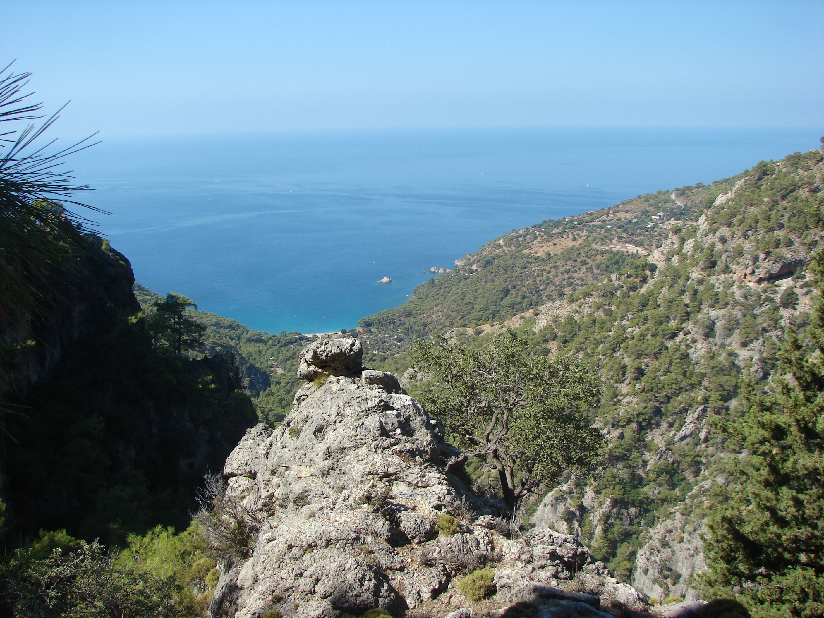
view down to the cove from
the path after it crosses
the bottom of the valley
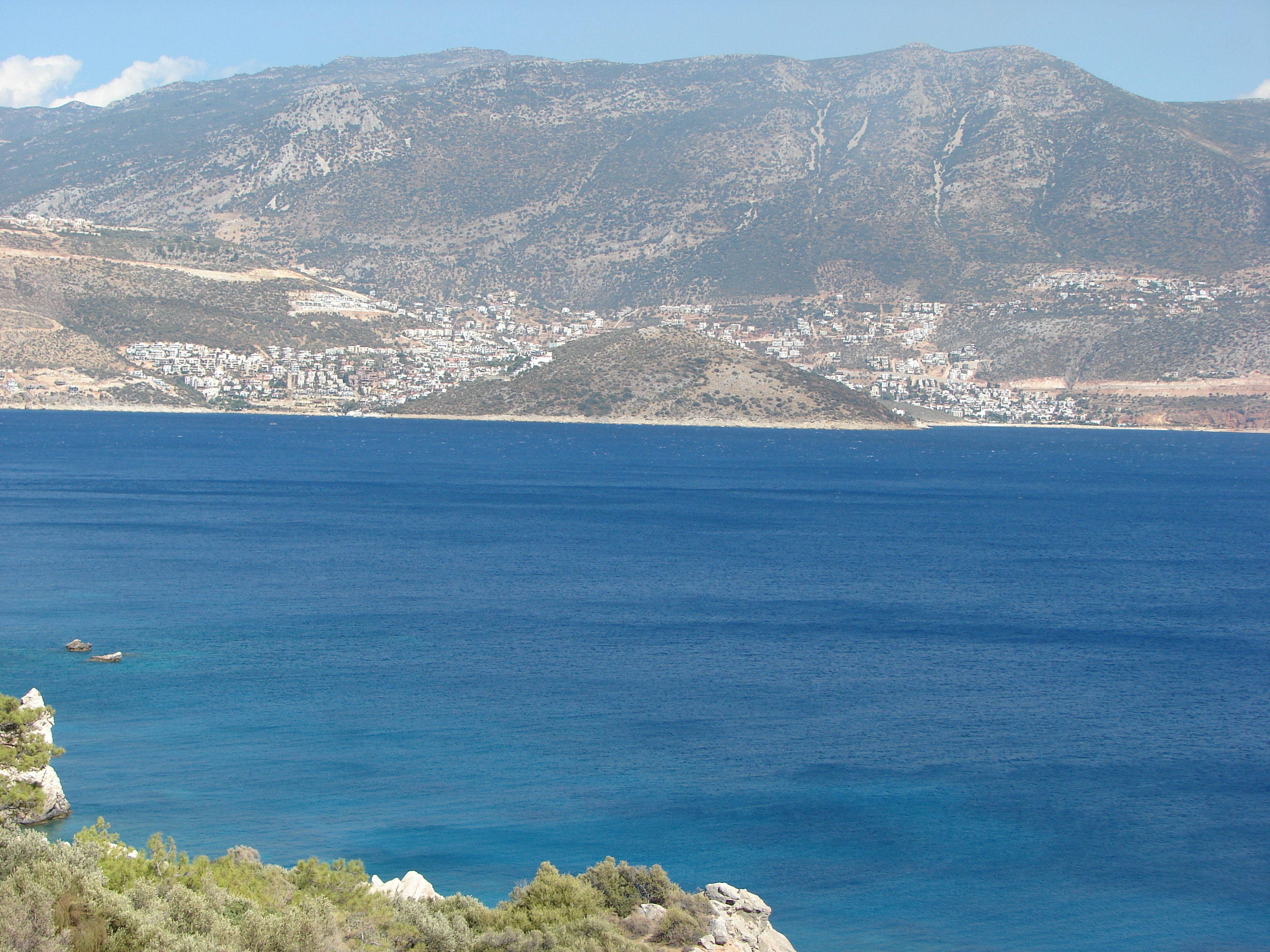
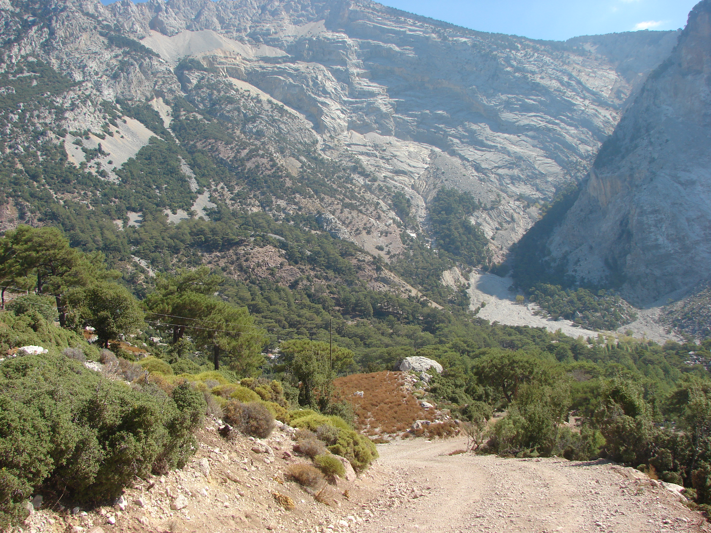
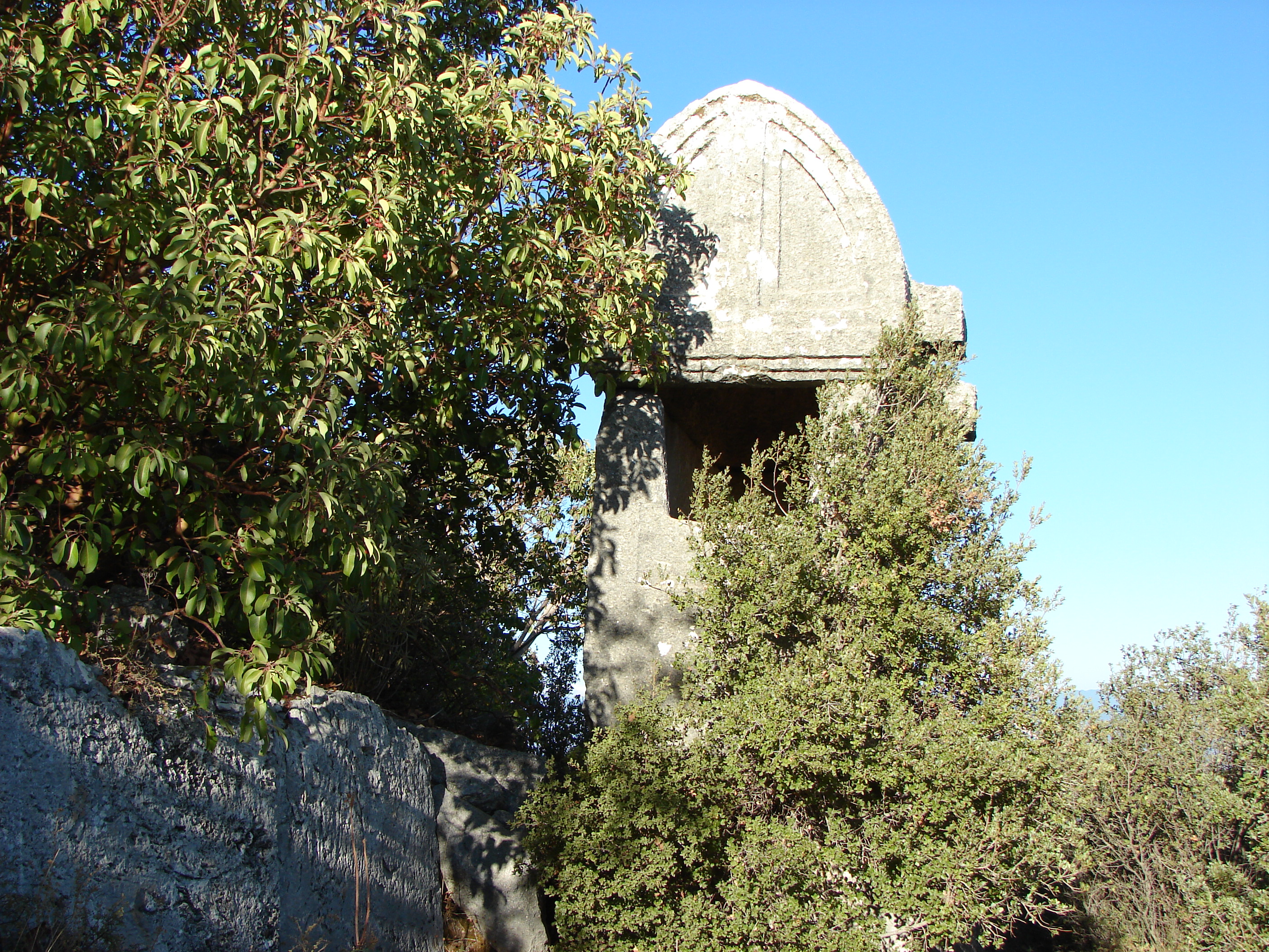
Above_Kalkan.jpg
looking down to the yayla road
out of Kalkan - there is a domed
cistern near the center
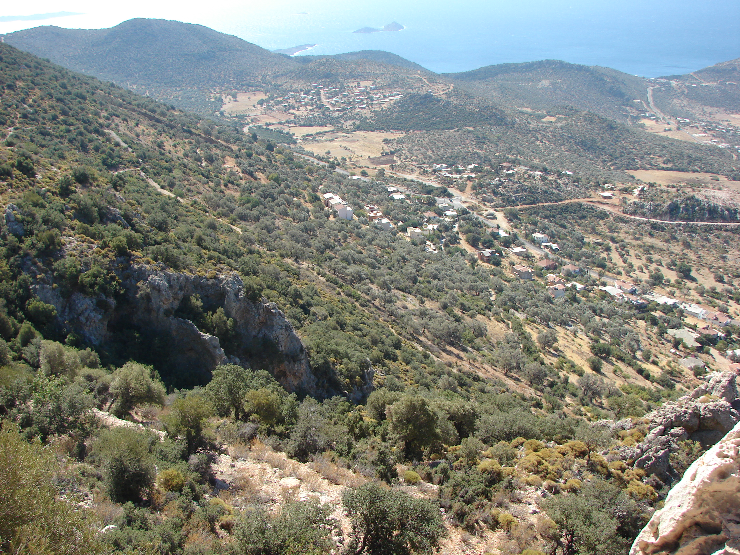
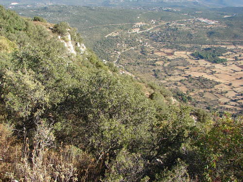
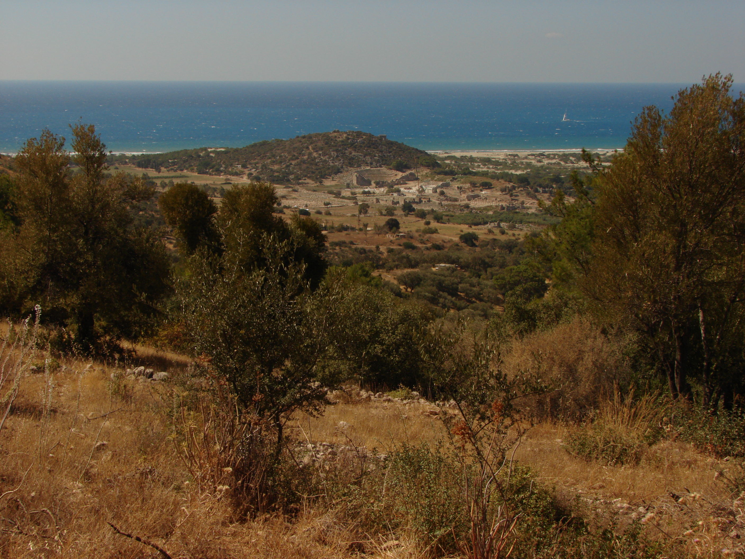
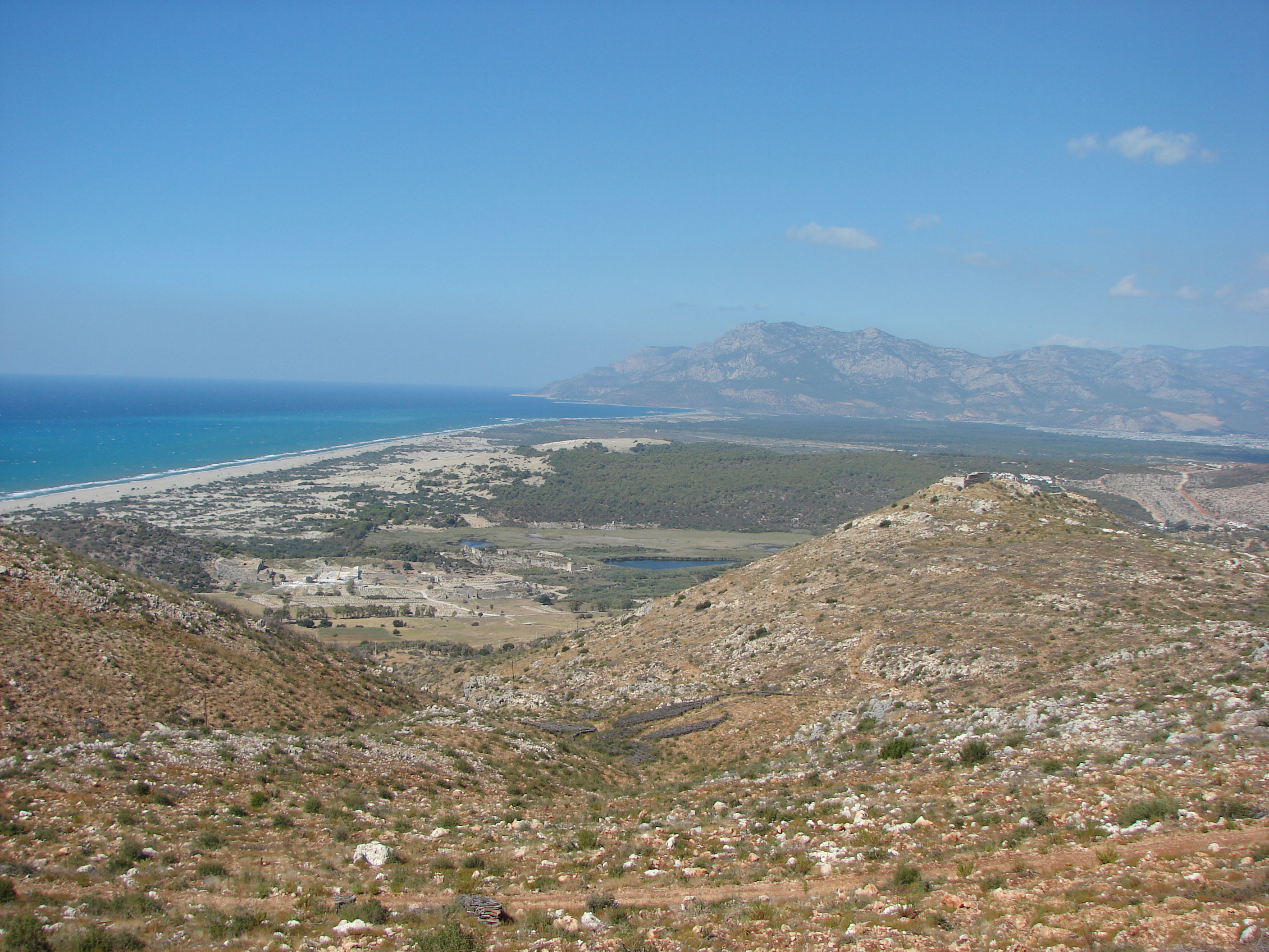
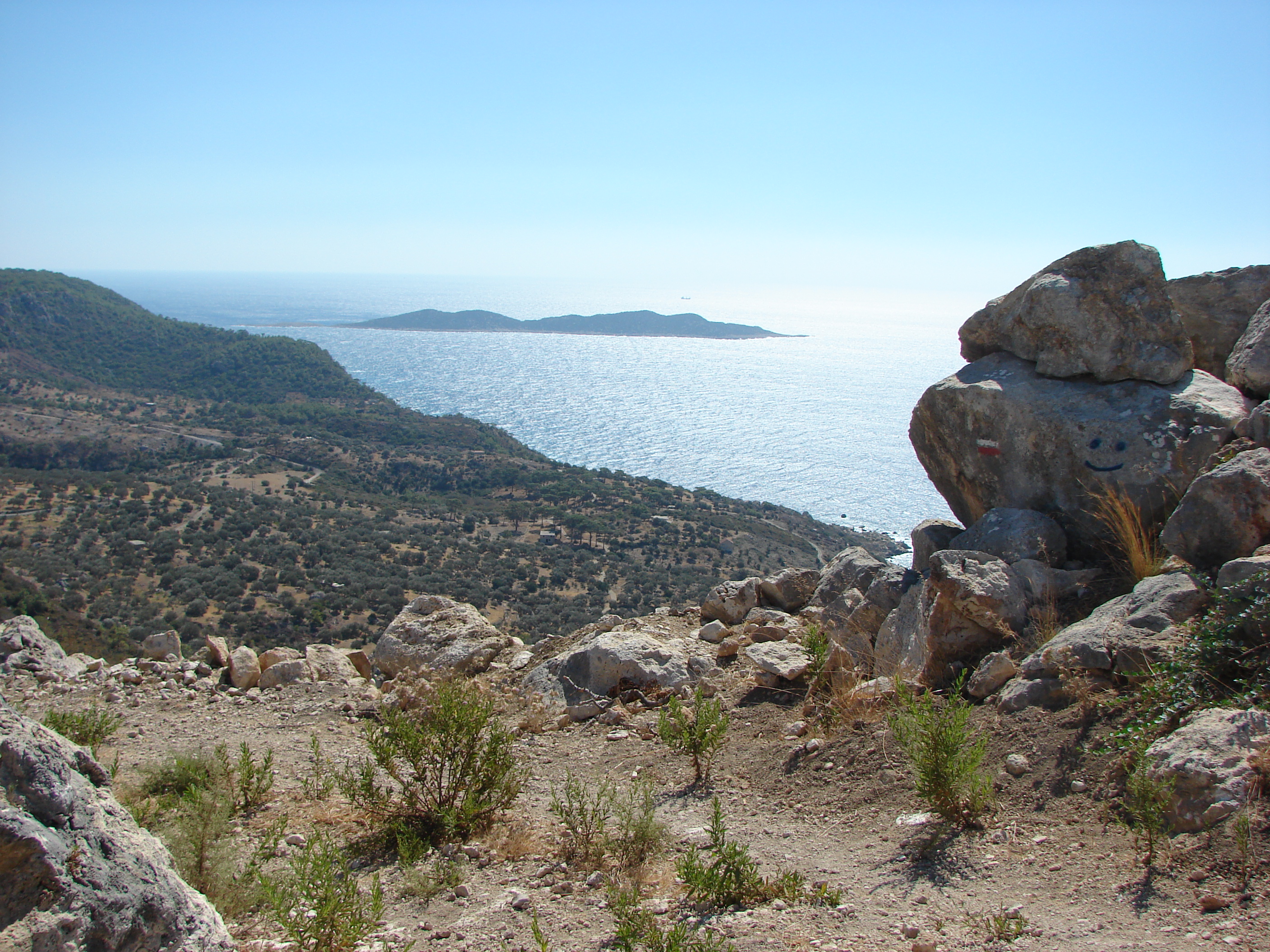
Above_Pydnai.jpg
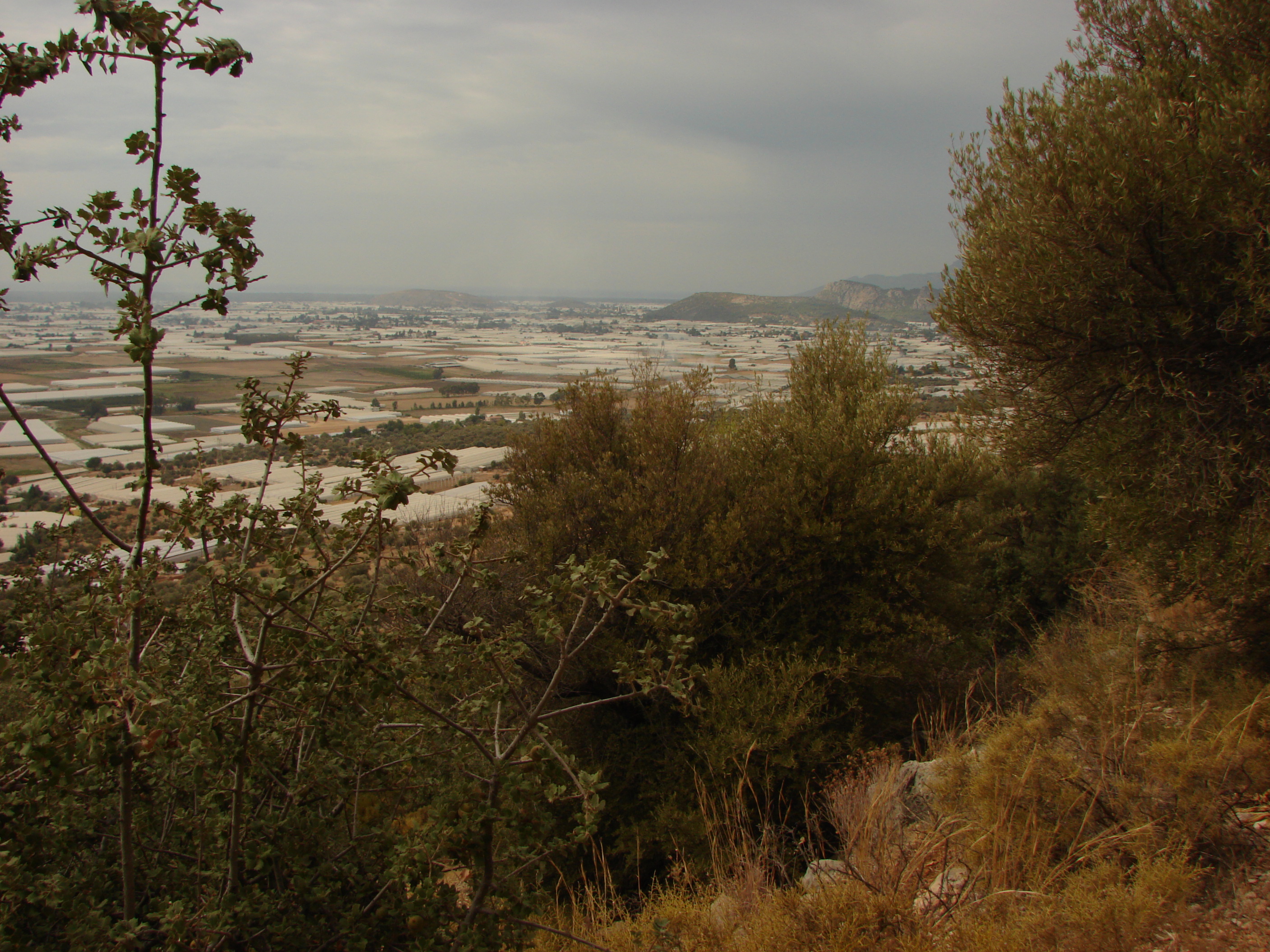
Pydnai below, Patara at the end of
the beach and greenhouse country
to the right
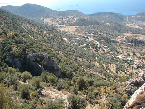
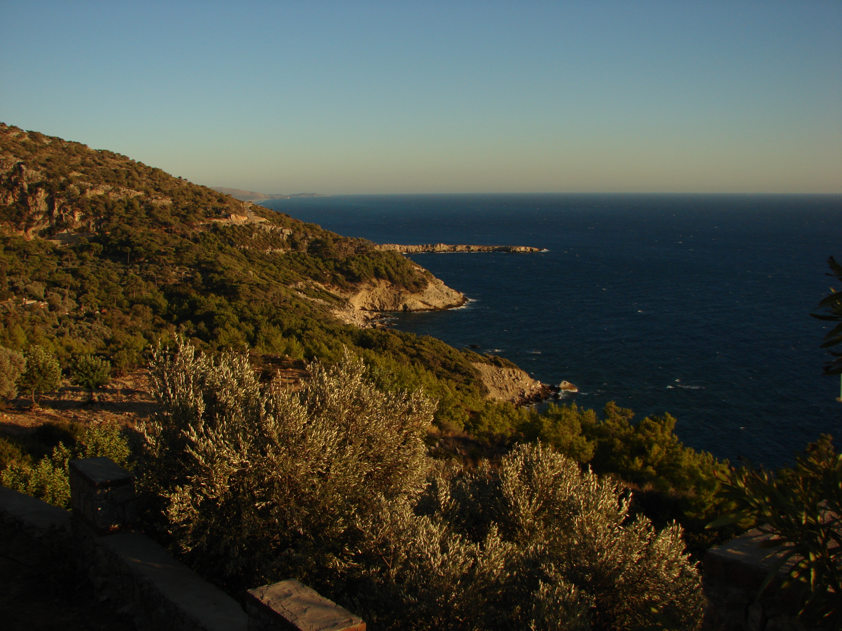
Akbel.jpg
looking back to Akbel

Alinga.jpg
looking down to the first of seven "noses"
"wicked nose", from Bayram's restaurant

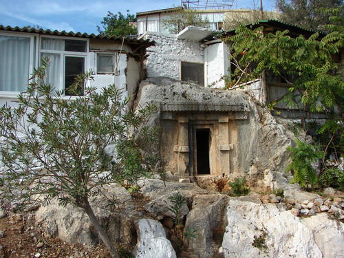
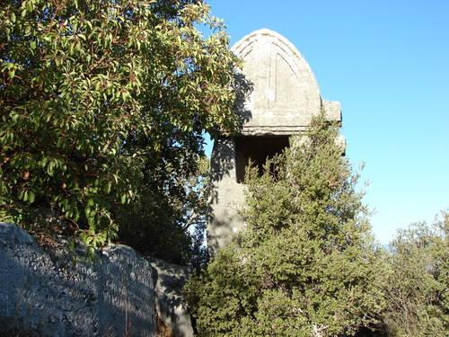
Antiphellos1.jpg
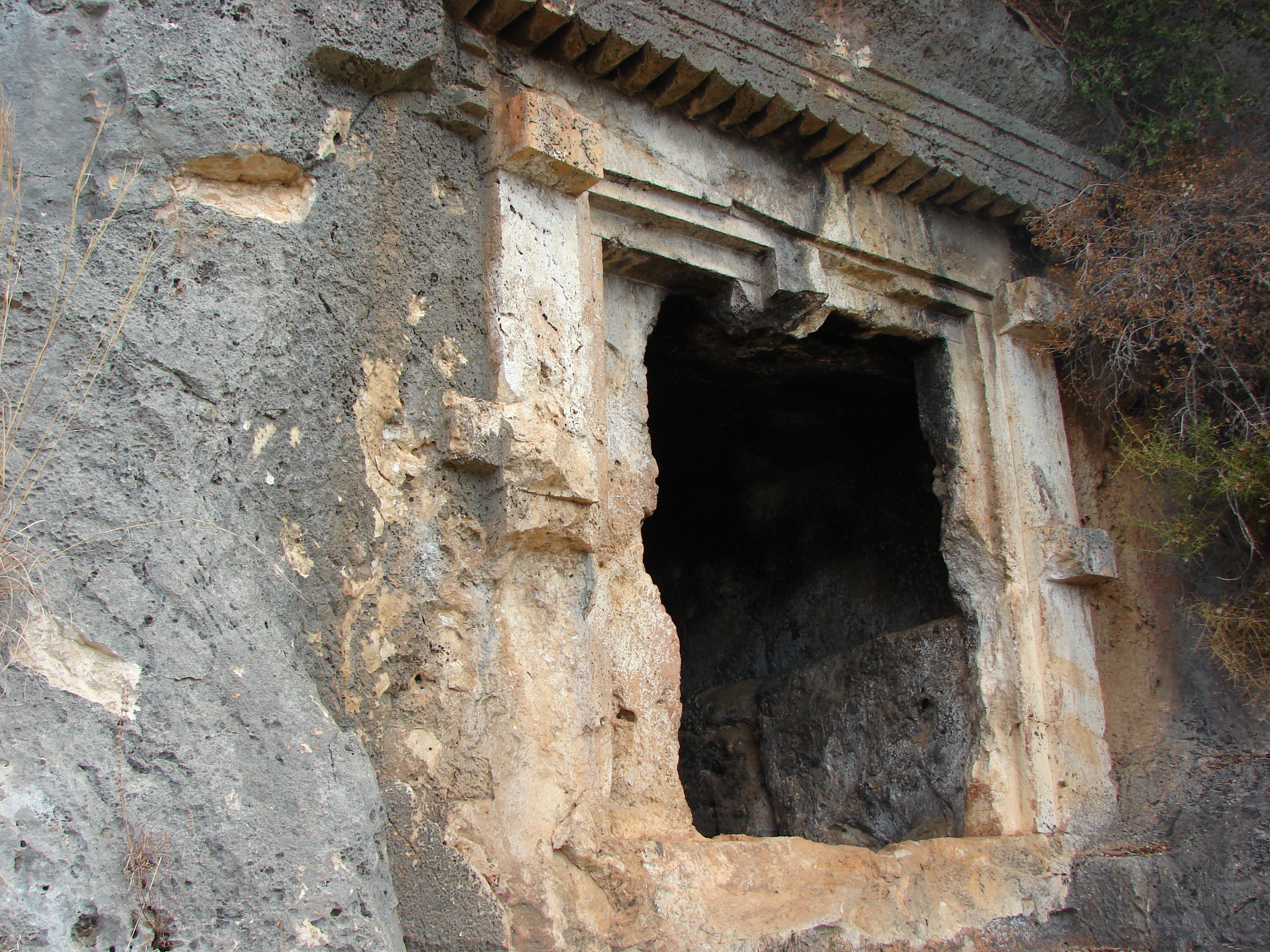
one of many lycian tombs carved
into the rock face above Kas
Antiphellos2.jpg
modern day Kas is on the site of
ancient Antiphellos
Antiphellos3.jpg
the Hellenistic theatre is still
used and was being renovated
Antiphellos4.jpg
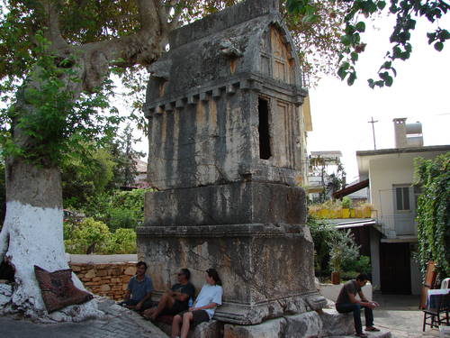
a typical Lycian sarcophagus
in the center of Kas

BabaDagi.jpg
"father mountain" seen from near
the start of the trail at Ovacik

Bel.jpg
the new, colourful mosque
at the top of the pass

Beyond_Akbel.jpg
the pass drops down to greenhouse
country on the left of the village
and Kalkan on the right

Beyond_Alinga.jpg
Bayram's restaurant is perched on the
ridge, near the right edge of the picture

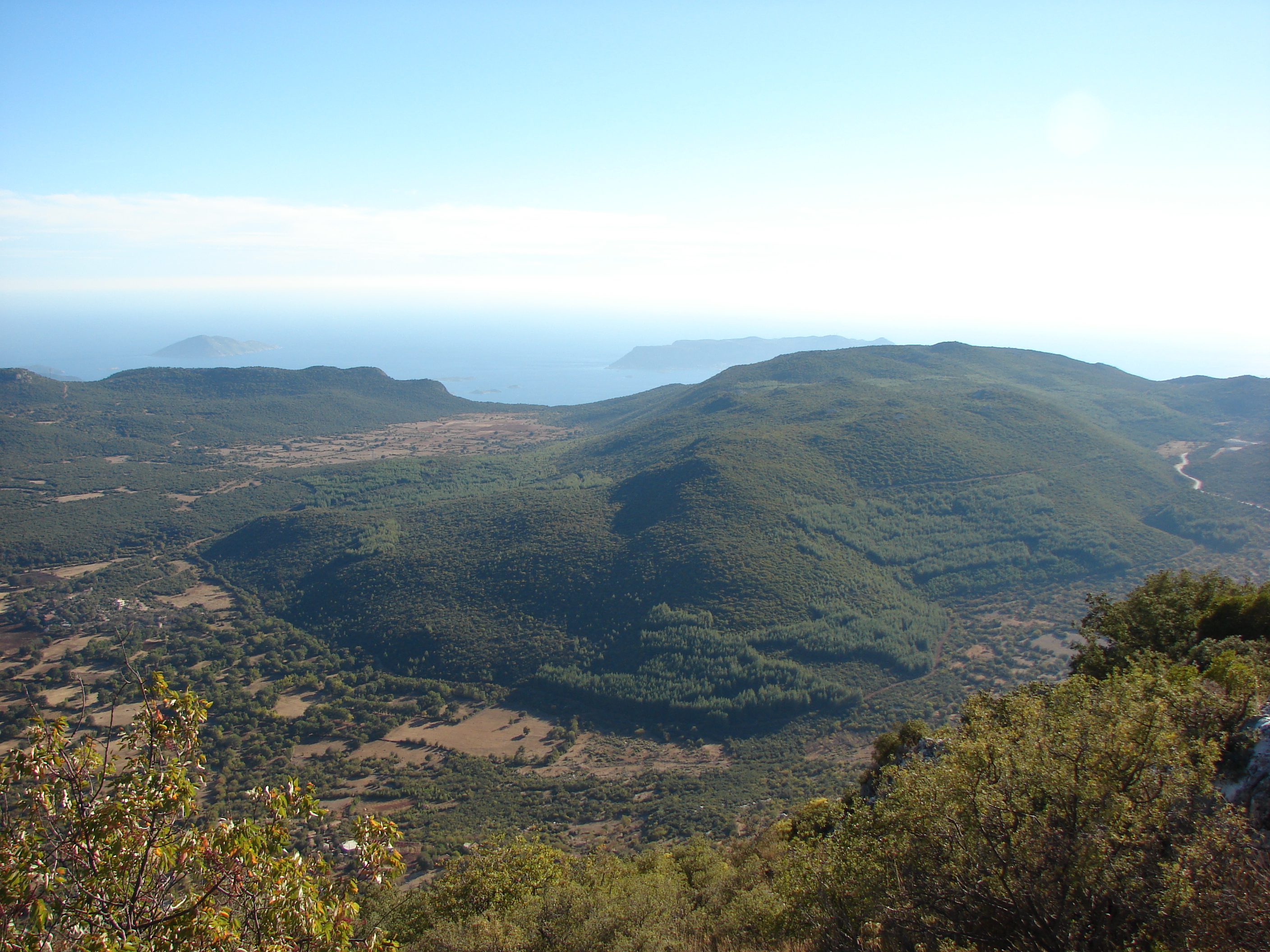
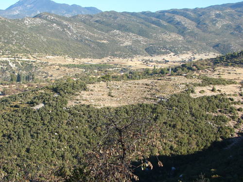
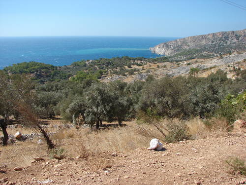
Beyond_Cavadir.jpg
looking back over Xanthos to Pydnai,
the full horror of greenhouse country
Beyond_Faralya.jpg
heading for the Kabak area
on a bulldozed track
Beyond_Gey.jpg
dropping down to the inlet after Gey
and before the climb up to Bel

Beyond_Saribelen1.jpg
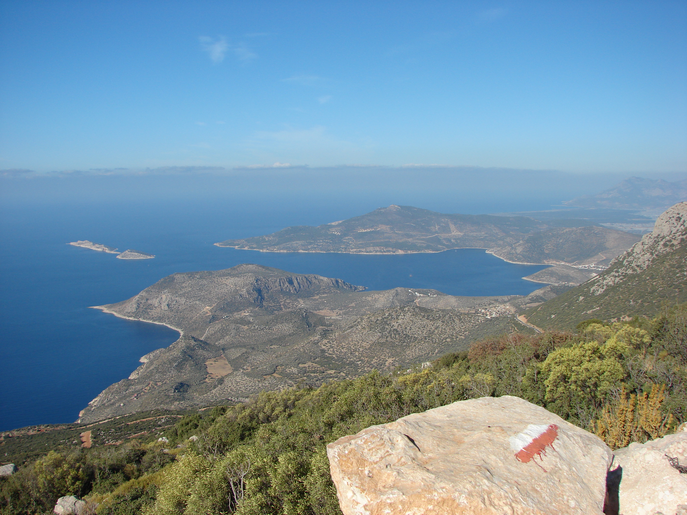
high above Saribelen, looking down to Kalkan,
just visble to the right
Beyond_Saribelen2.jpg
approaching the cultivated fields
high above Saribelen, at Sidek

Bezirgan1.jpg
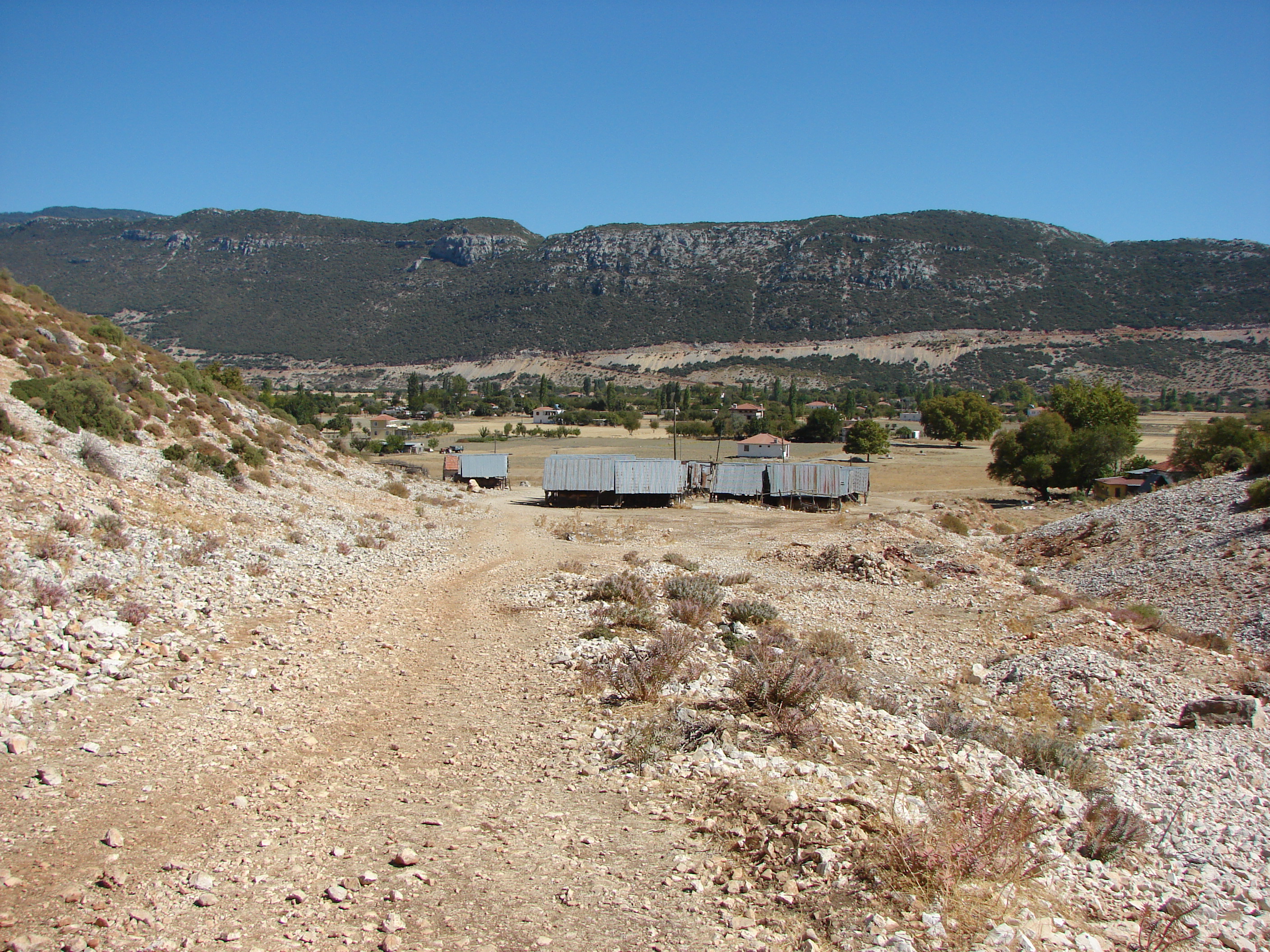
the approach to Bezirgan
over the pass above Kalkan
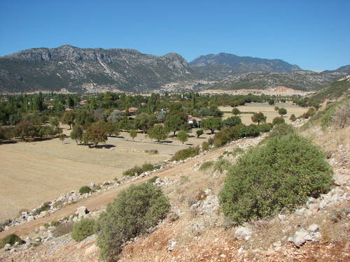
Bezirgan2.jpg
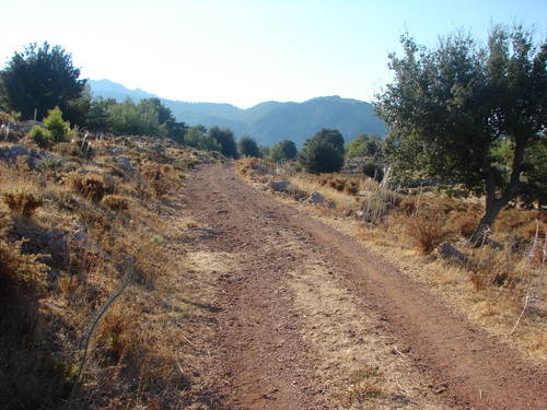
start of the climb out of
the Bezirgan ova

Cukurbag1.jpg
from Phellos 800m up, Cukurbag below left
and Meis / Kastelorizo a mile or so off
the mainland
Cukurbag2.jpg
another shot of Cururbag from Phellos,
at the edge of the Felen ova
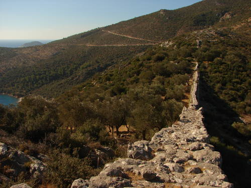
Delikkemer1.jpg
an astounding piece of Roman civil
engineering; a siphonic system to
pipe water across a valley

Delikkemer2.jpg
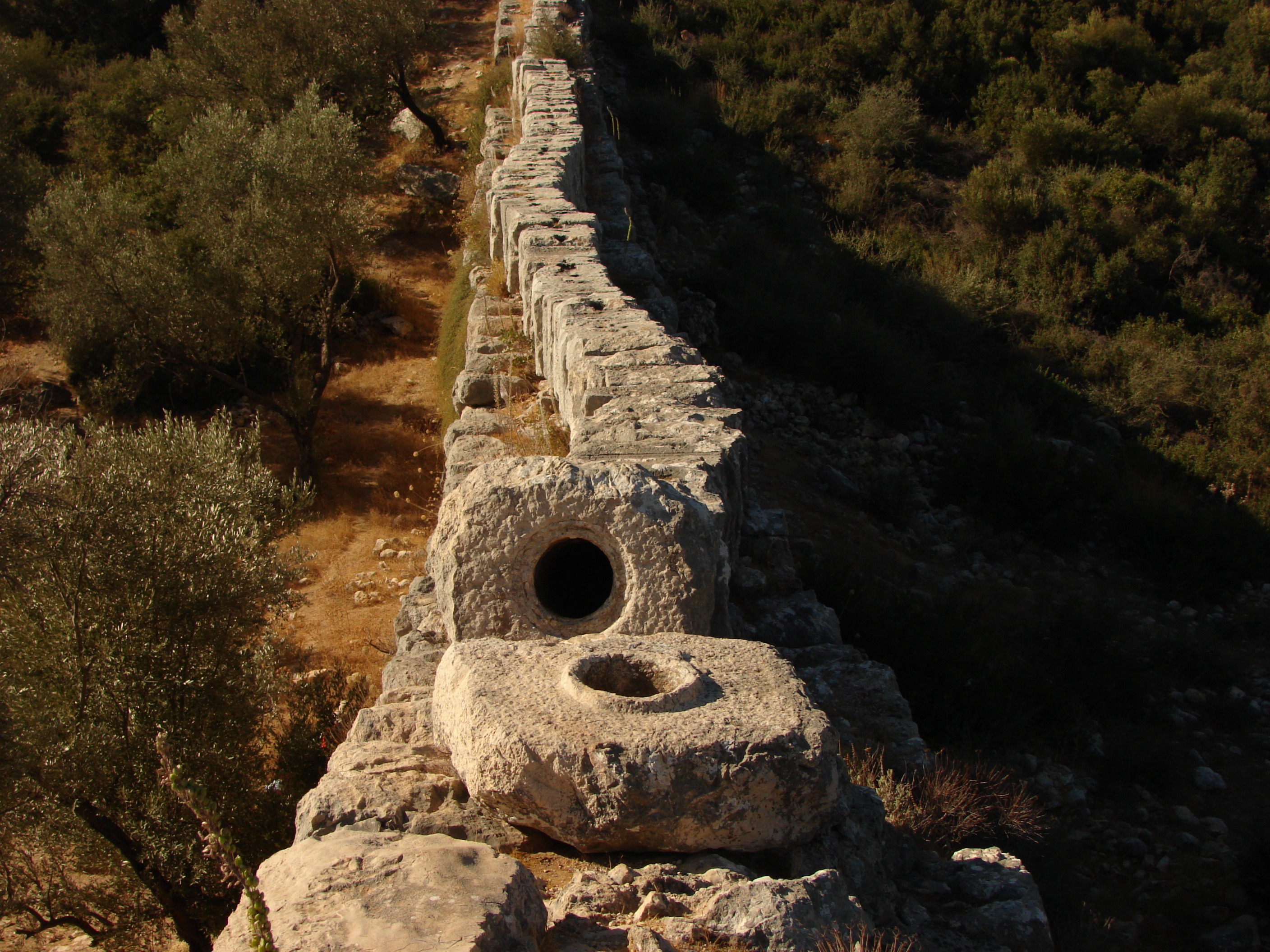
view of the spigot and socket of
the stone blocks; about a thousand
made up the working siphon
Delikkemer3.jpg
the wall supporting the siphon; the
opening to the right is about 9 feet high

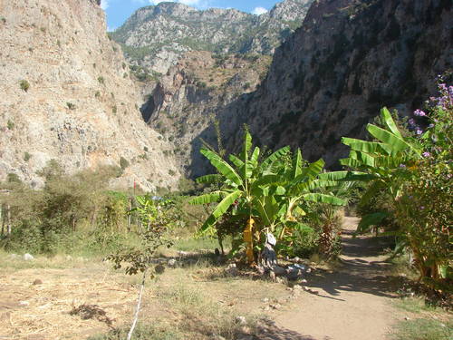
FaralyaBeach.jpg
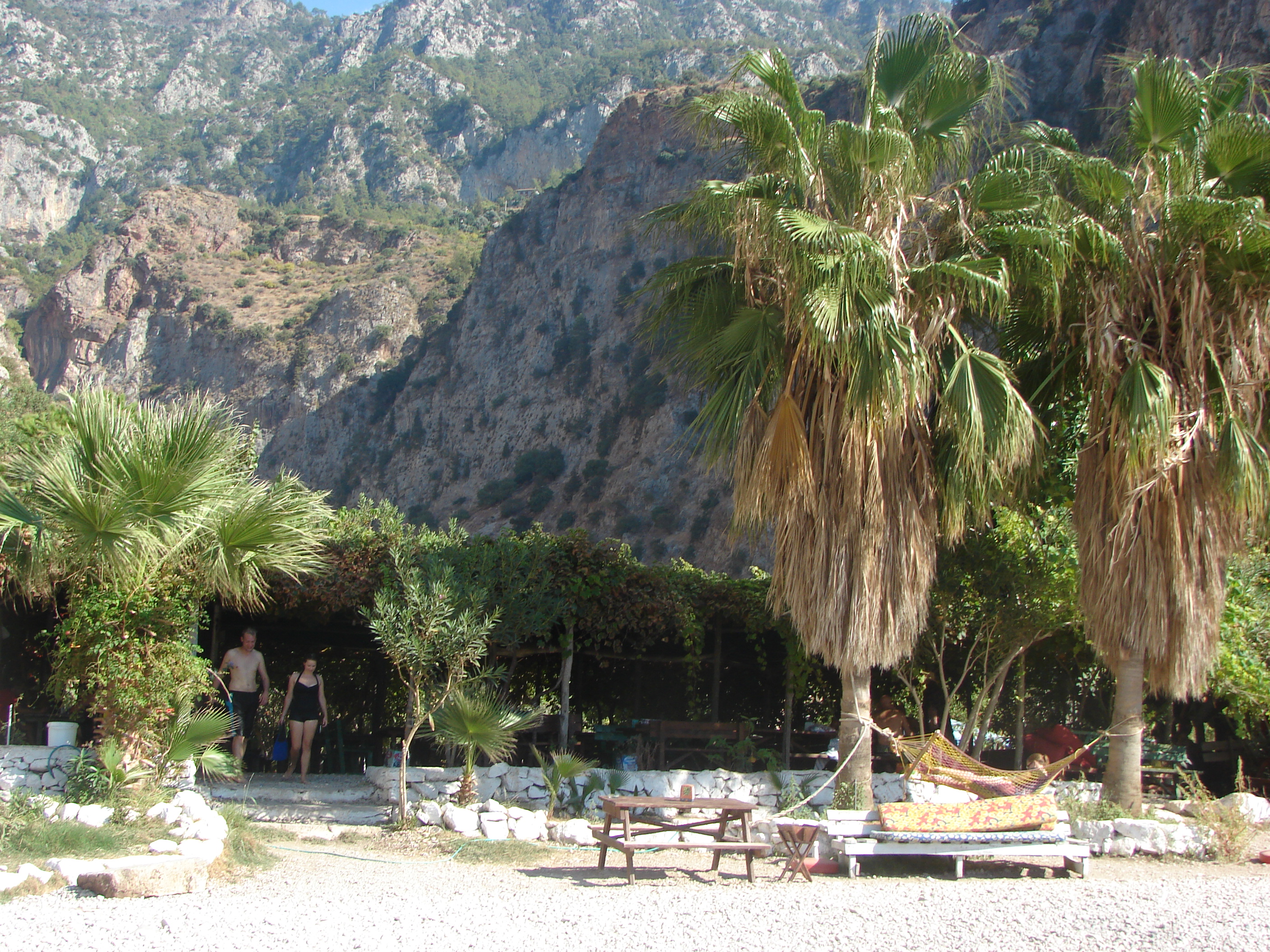
Faralya village is high above
the two Washingtonia palms
FaralyaValley1.jpg
George House in the Village is
just behind the ridge on the
right of the valley;
a couple can be seen near
the bottom of the path
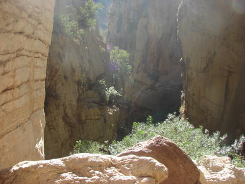
FaralyaValley2.jpg
further to the back of the valley
FaralyaValley3.jpg
and further back still

FaralyaValley4.jpg
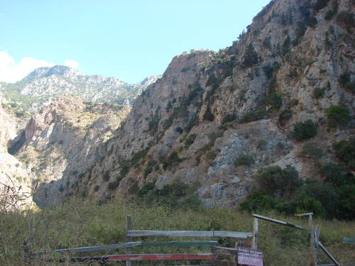
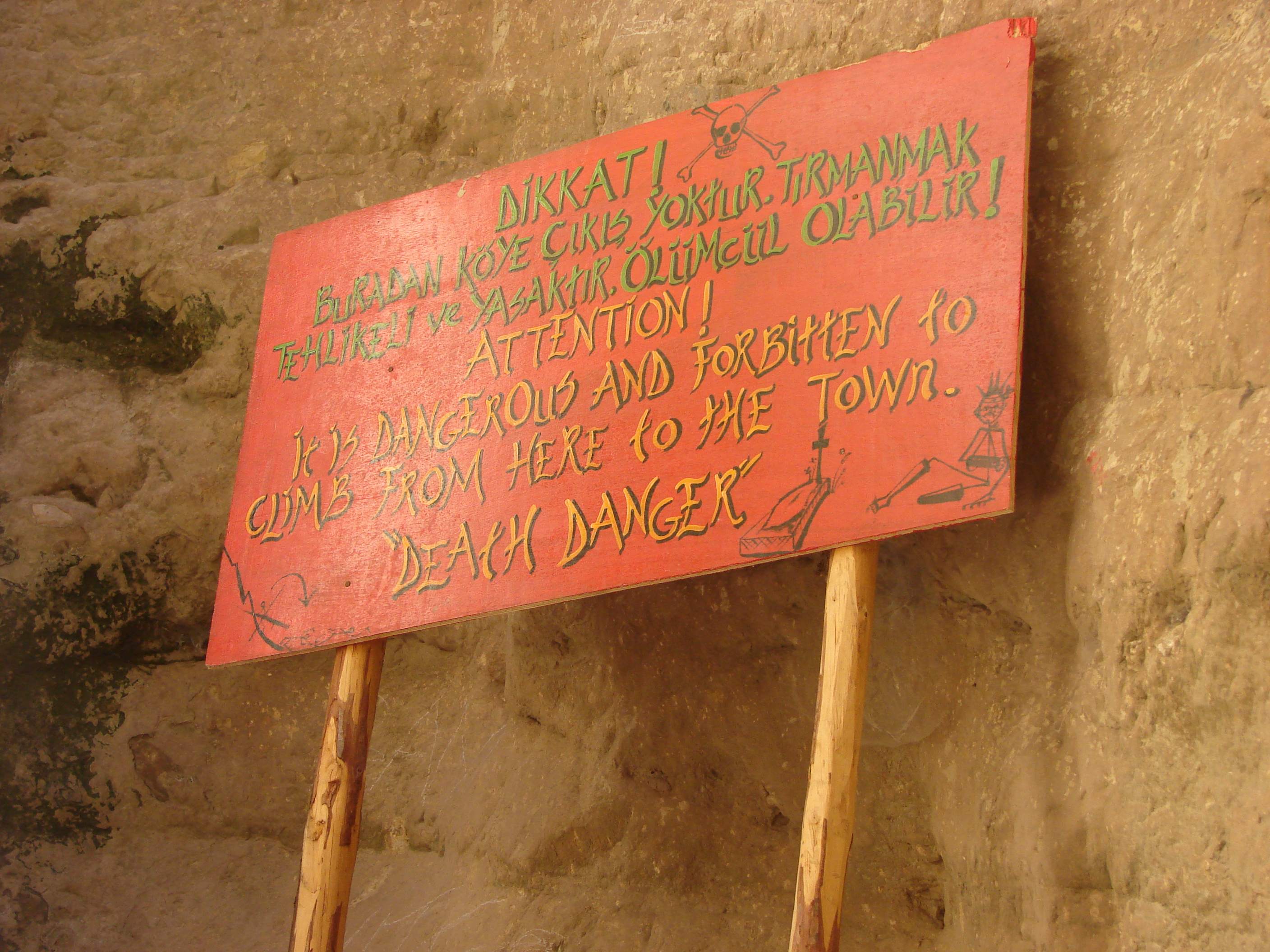
this warning at the very back by
the waterfall - the official route
up is dodgy enough!
FaralyaVillage.jpg
Faralya as seen from the descent from Kirme

Gavuragli.jpg
one of the "noses" seen from the
rich returnee's fortified pad

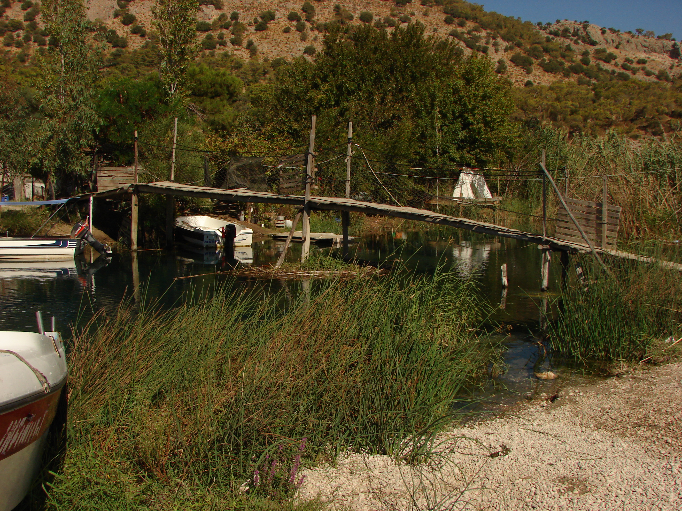
Inpinar.jpg
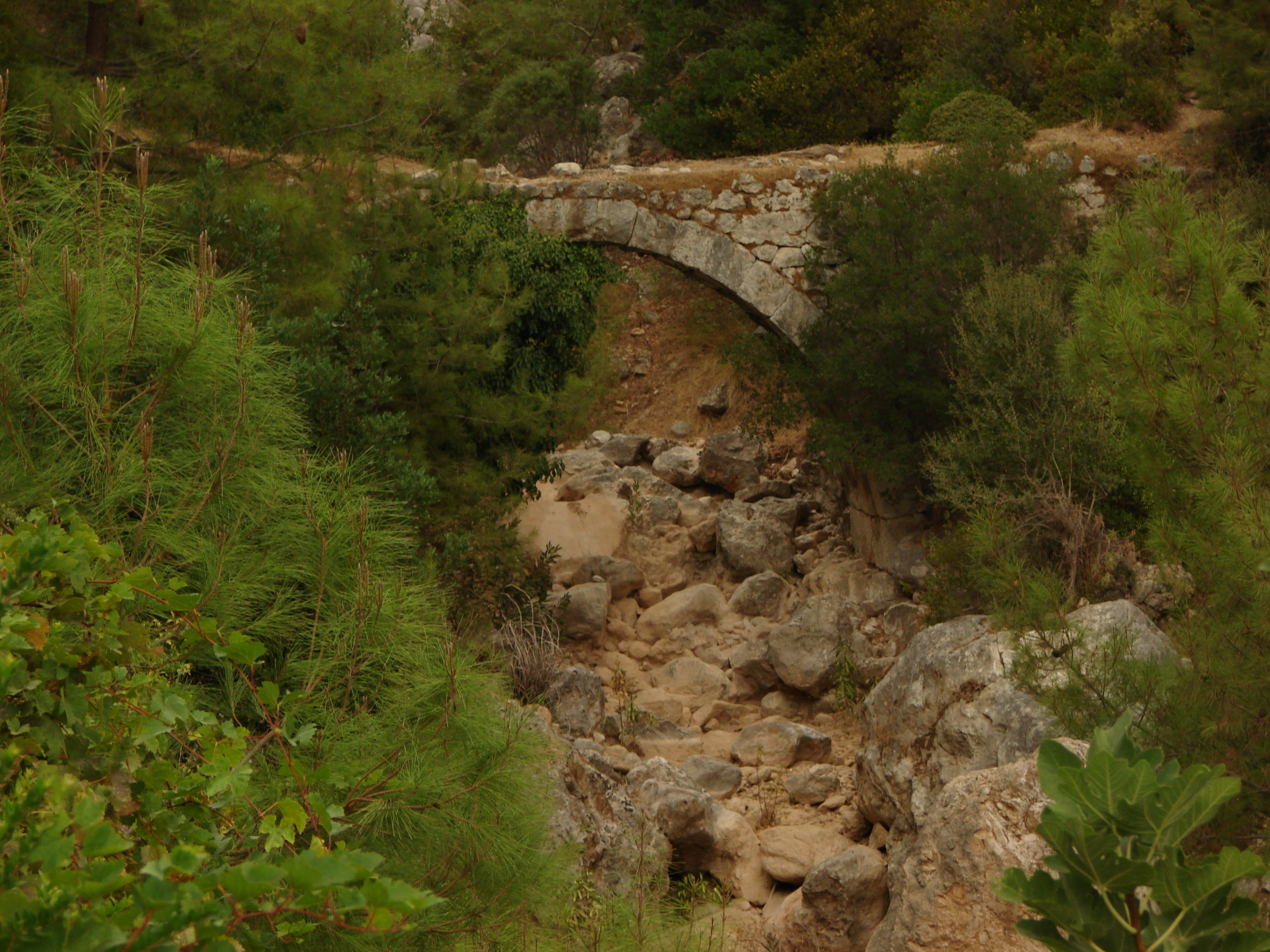
the bridge at Inpinar; the still
in use aqueduct is just to the left
KabakBeach.jpg
from the approach from Faralya
looking down to the beach
Kabak.jpg
and to the village from the same spot

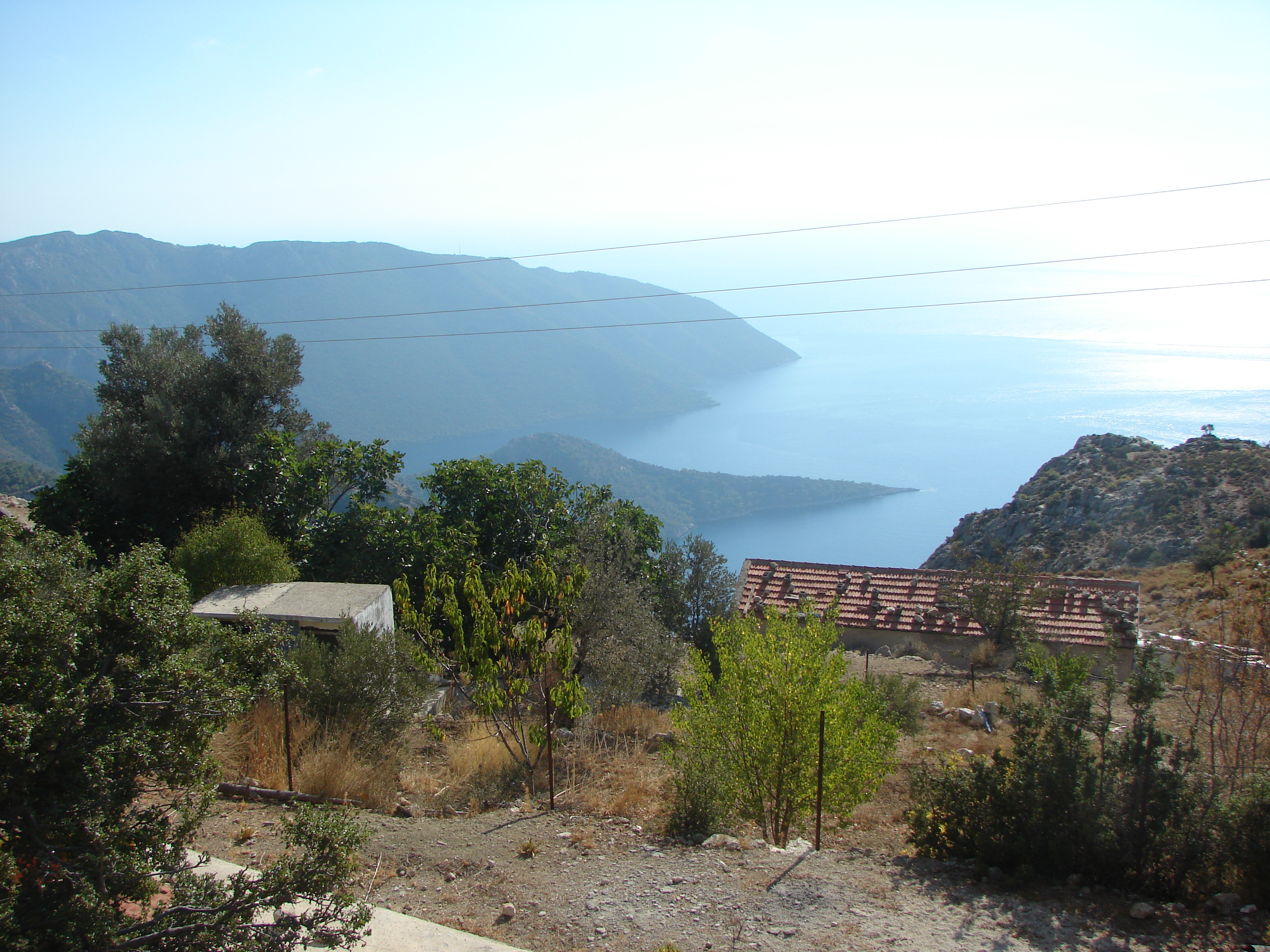
Kalkan.jpg
approaching Kalkan on the
"path" east of Delikkemer

Karabak.jpg
part of the village just visible
below the bend in the track;
Baba Dagi behind

Kas.jpg
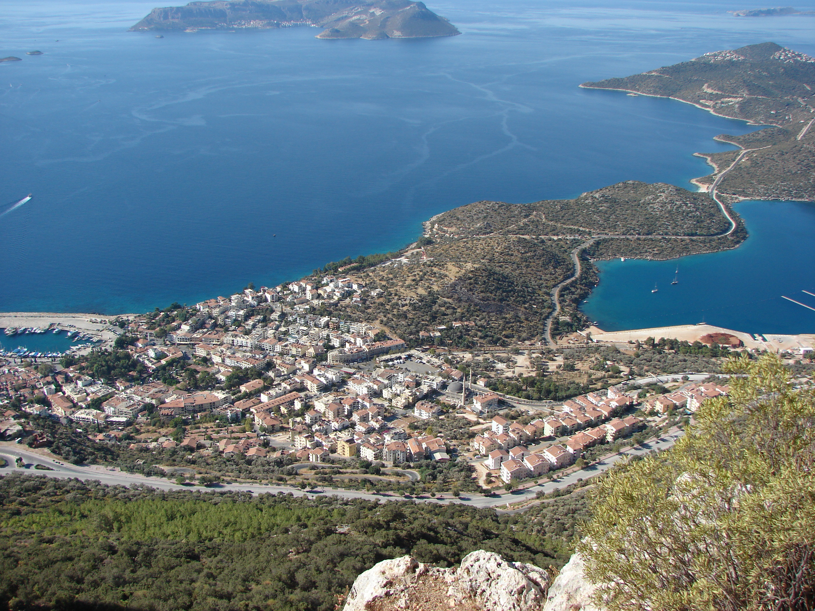
Kas from the edge of the Felen
plateau; Meis / Kastelorizo behind
Kirme.jpg
looking back at the village
Baba Dagi looms behind
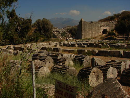
Letoon1.jpg
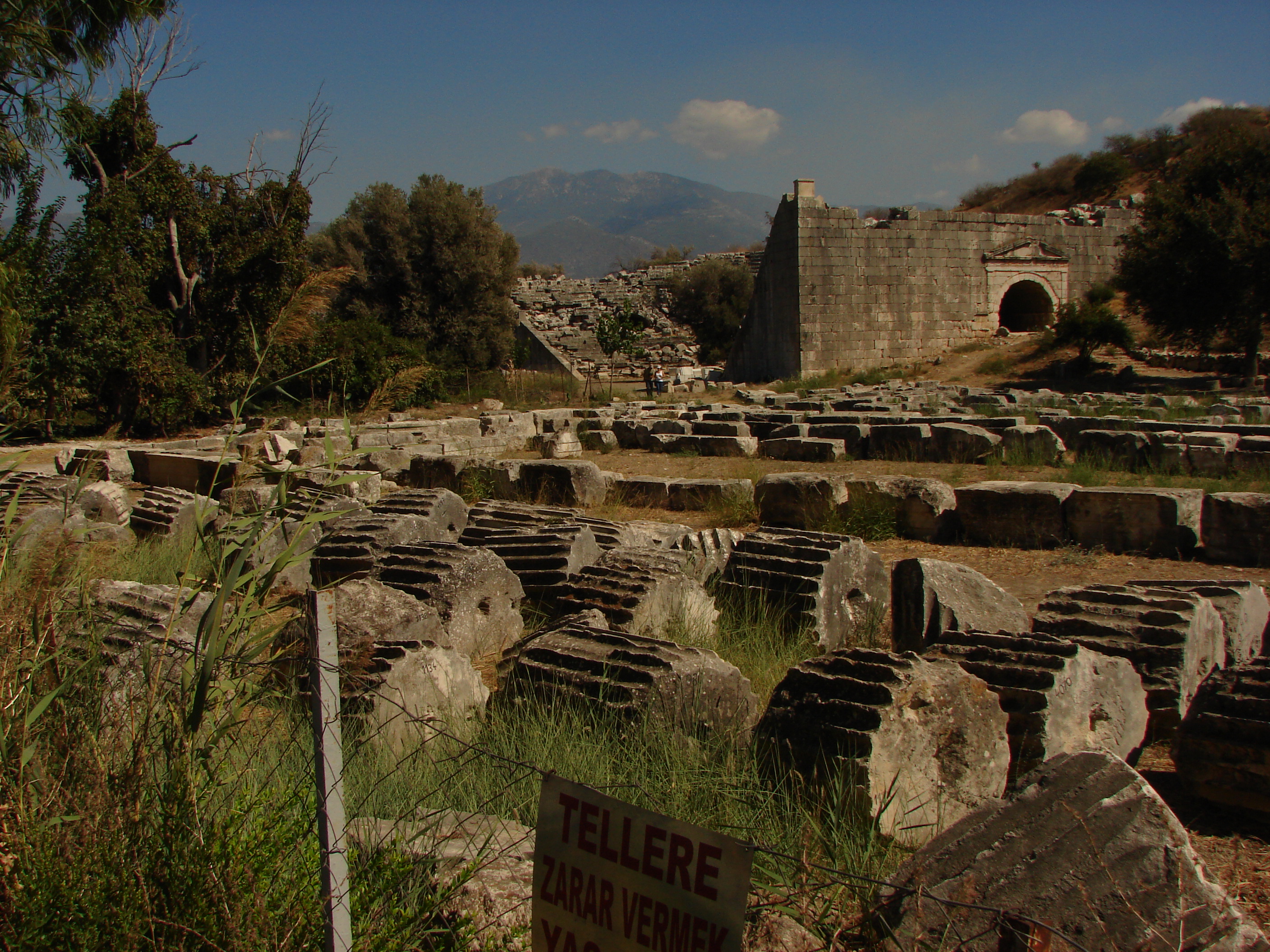
Letoon was sacred to Leto
and her twins (Apollo & Artemis)

Letoon2.jpg
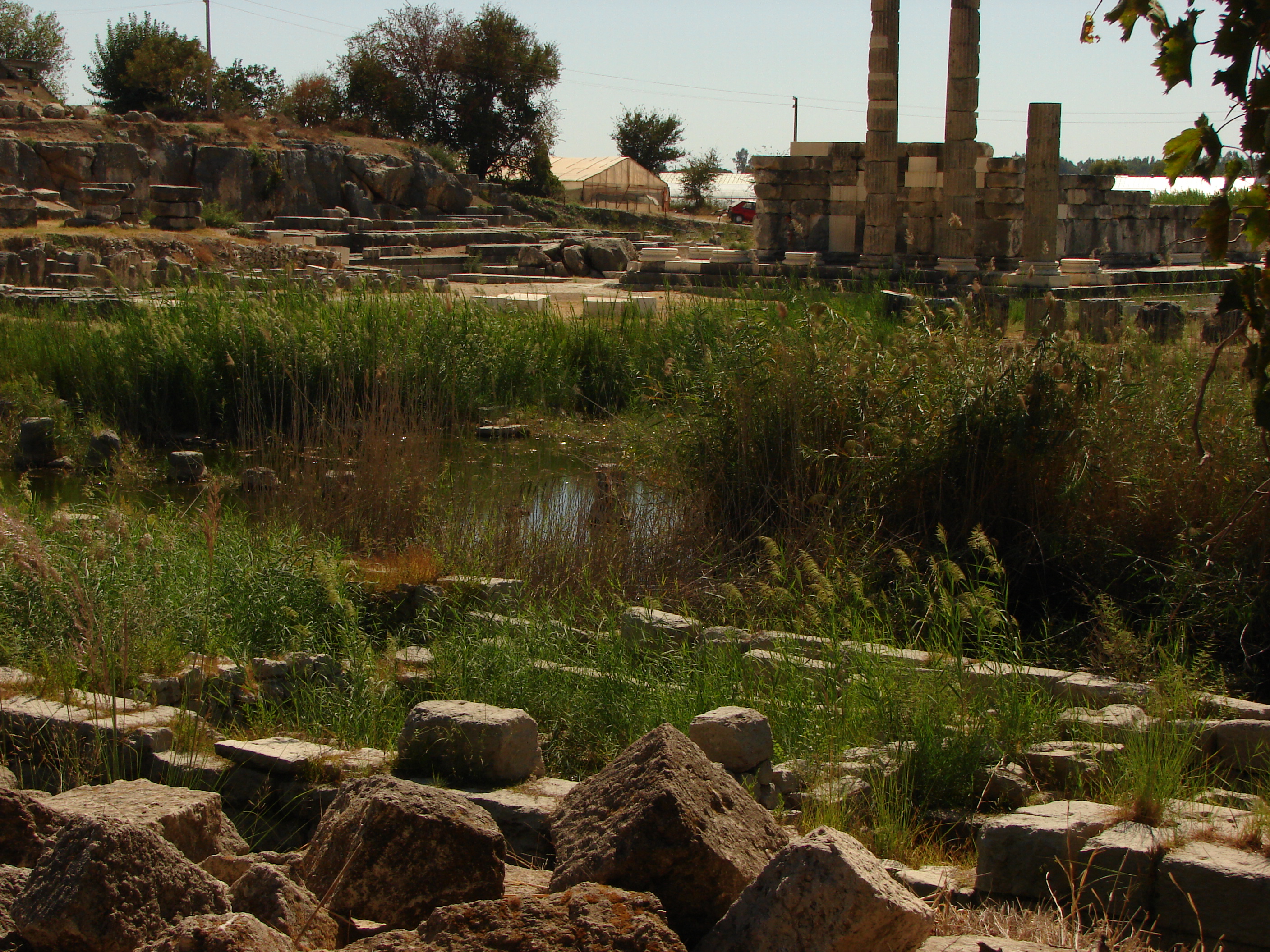
Letoon3.jpg
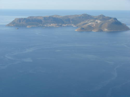
Meis_from_Felen.jpg
from the same spot as the view
down to Kas - Kastelorizo is the
most easterly of the Dodecanese

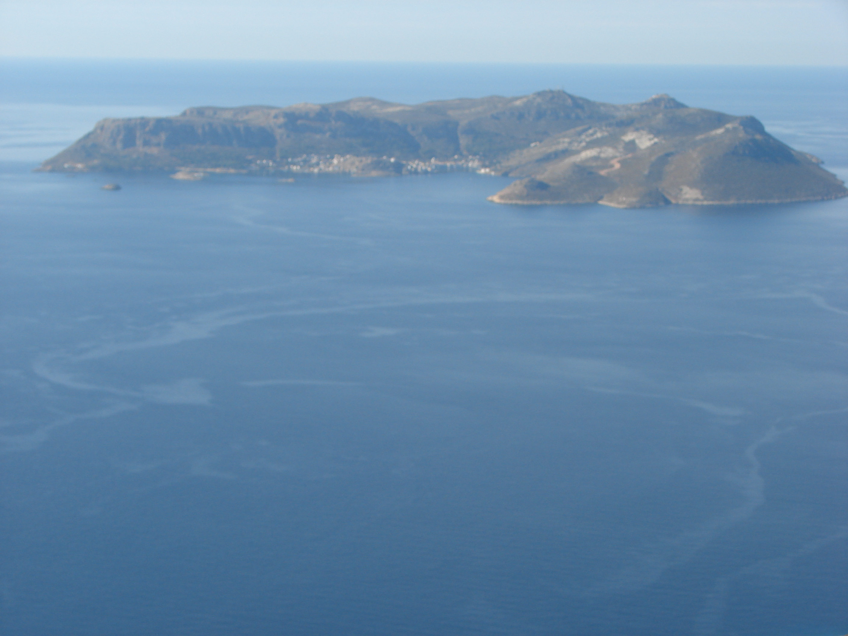
Meis_from_hotel.jpg
Kastelorizo viewed from the roof
of the Caretta pansiyon
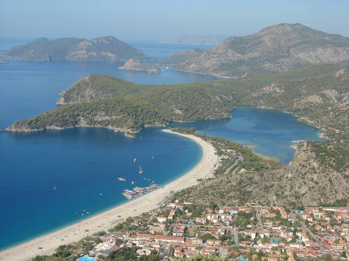
OluDeniz.jpg
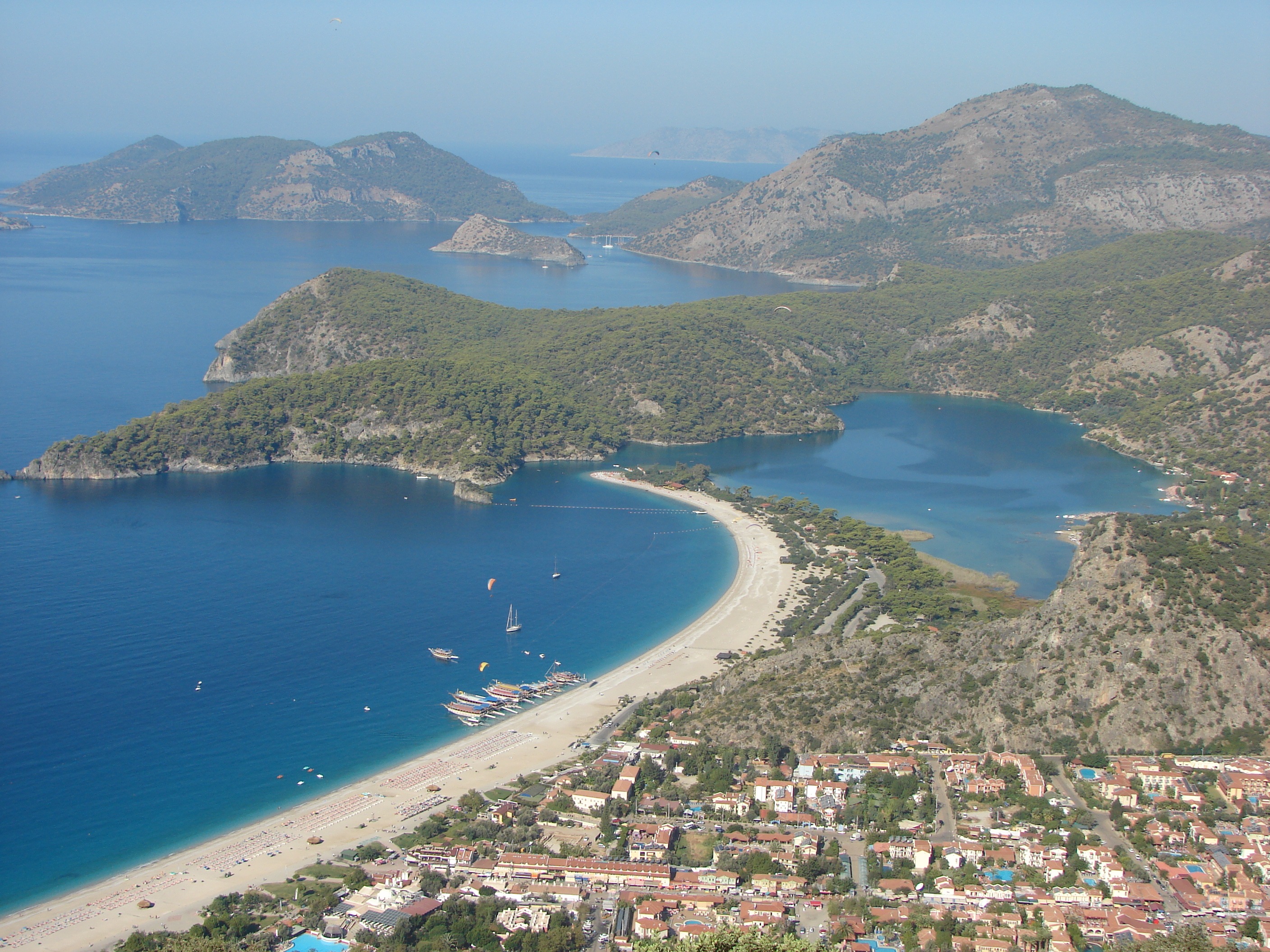
the lagoon, beach & swimming
pools of the notorious tourist
trap
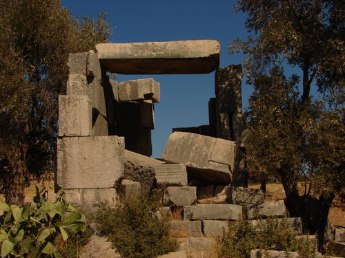
Patara1.jpg
a ruin on the hill above
the main part of the city

Patara2.jpg
looking down on Patara from
the hills to the east
Patara3.jpg
Patara beach reaches back to
Pydnai; greenhouse country starts
to the right in the distance
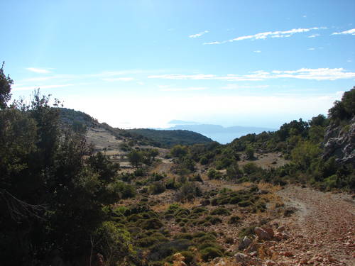
Path_to_Phellos1.jpg
these taken along the high level
path inland from Gokceoren
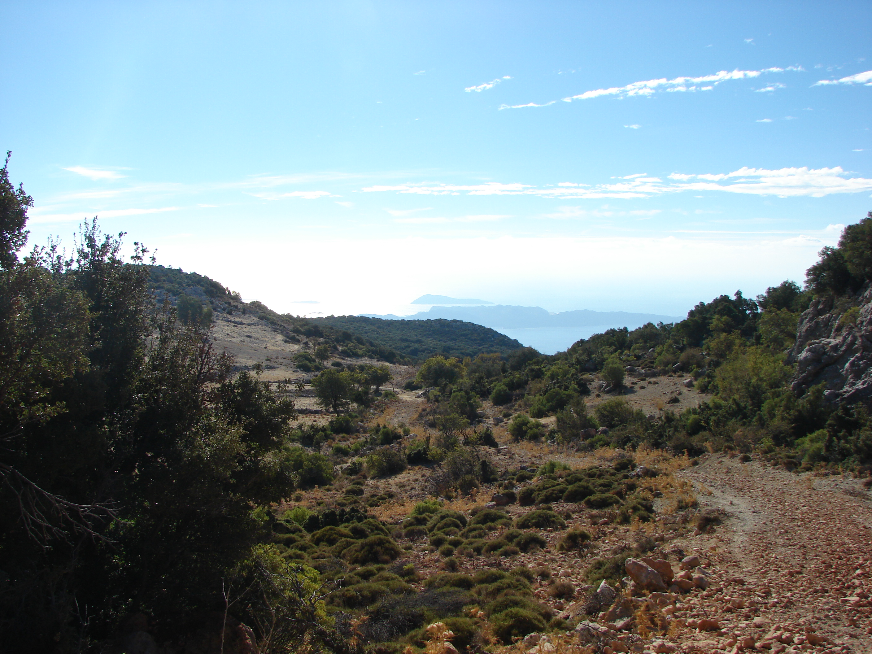
Path_to_Phellos2.jpg
for most of the way it was shaded with
high scrub, but with occasional breaks
giving panoramic inland views
Path_to_Phellos3.jpg
along here I saw wild ponies and boar!
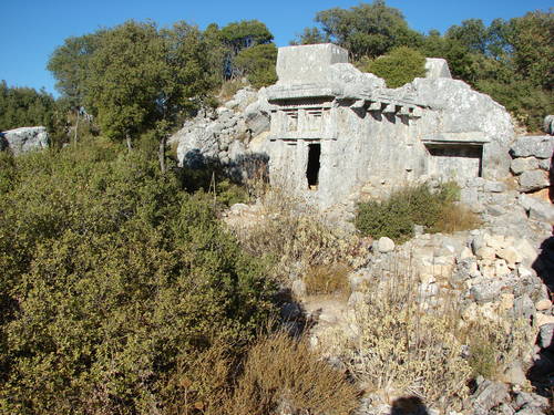
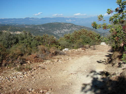
Phellos1.jpg
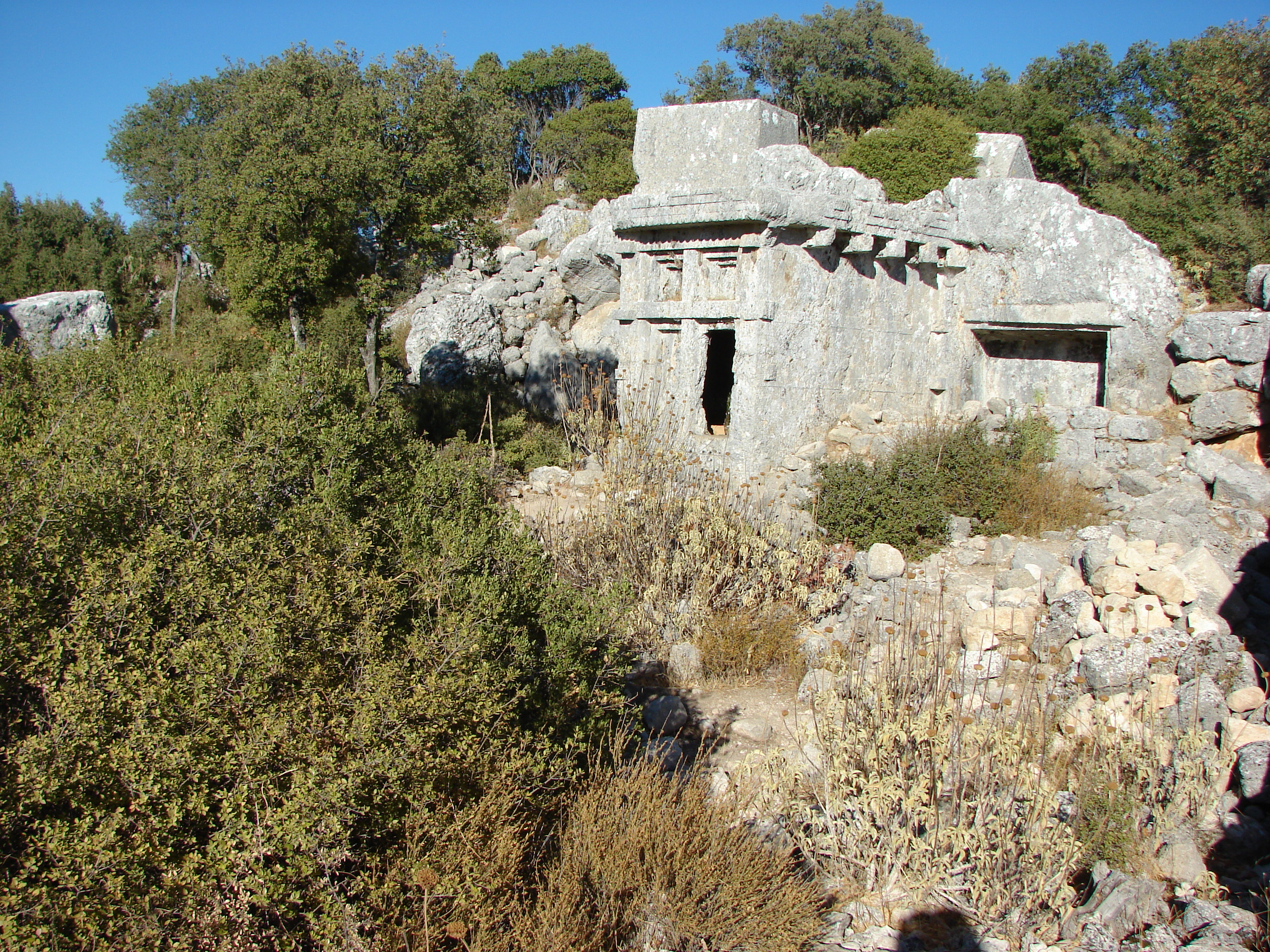
the ancient city on an 800m high ridge
no entrance fee!
Phellos2.jpg

Pydnai_bridge.jpg
the rickety bridge that crosses
the Esen river at the edge of
greenhouse country

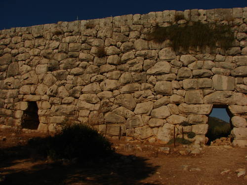
Pydnai_fort1.jpg
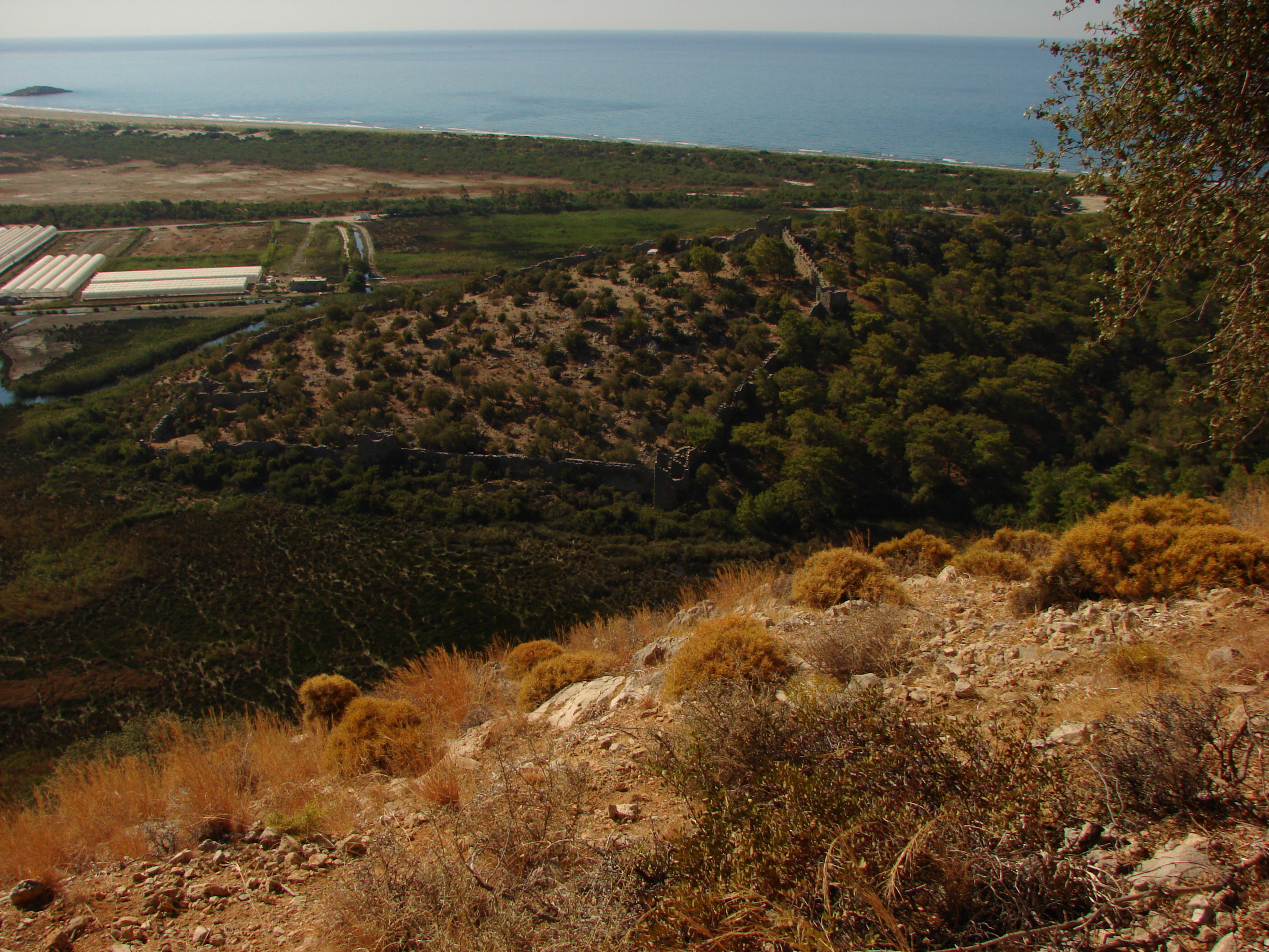
the fortress at Pydnai seen from the
ridge beyond Gavuragili
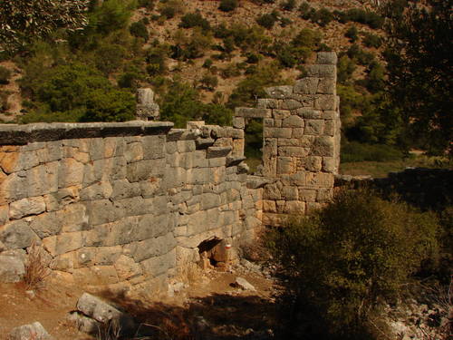
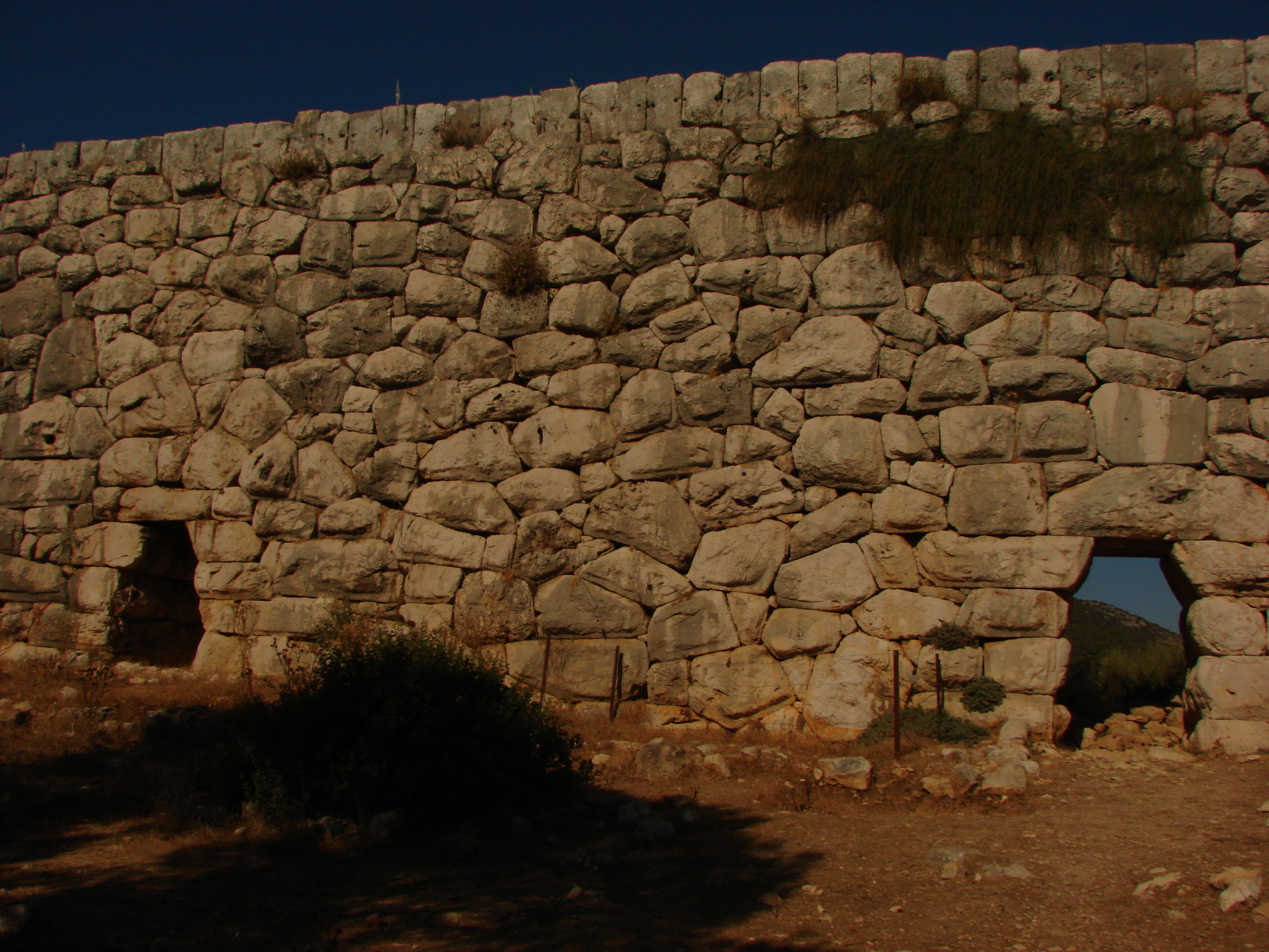
Pydnai_fort2.jpg
inside the fortress
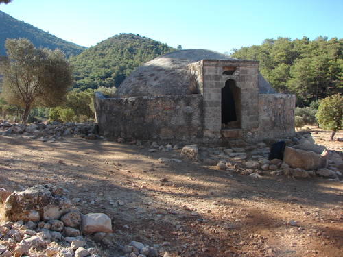
Sancakli.jpg
the Ottoman cistern between
Alinga & Gey
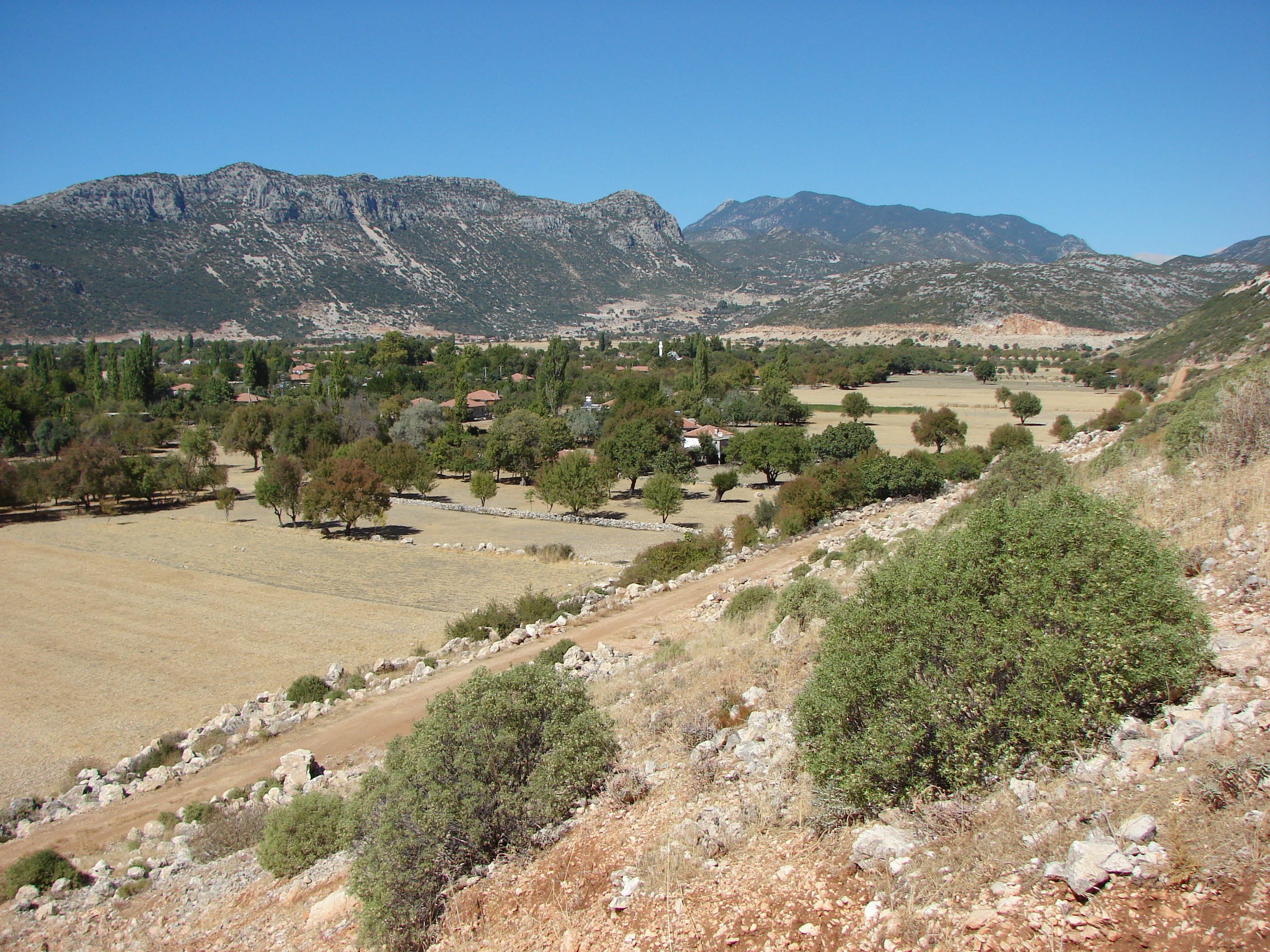
Saribelen.jpg
looking back to Saribelen;
Bezirgan is at the foot of
the background ridge

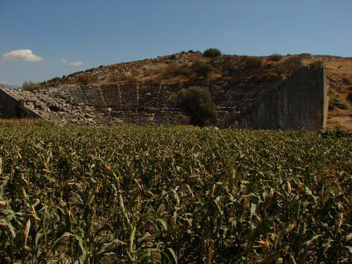
Xanthos1.jpg
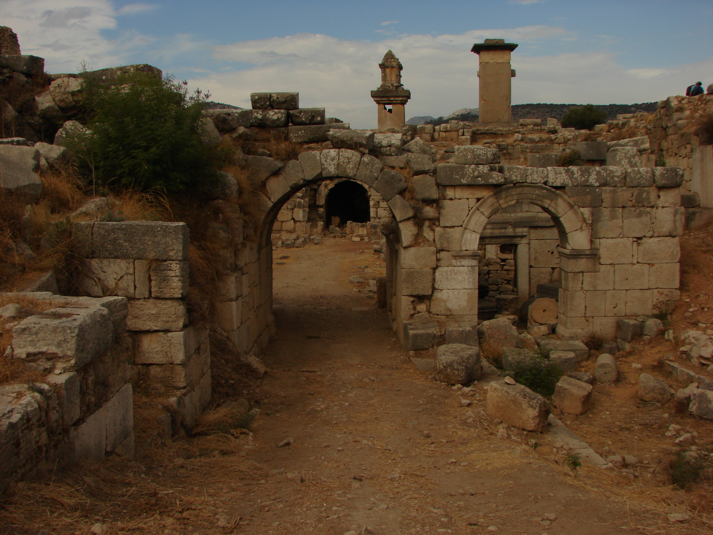
Xanthos was an important Lycian
city; it's finest remains were
stolen by the British Museum

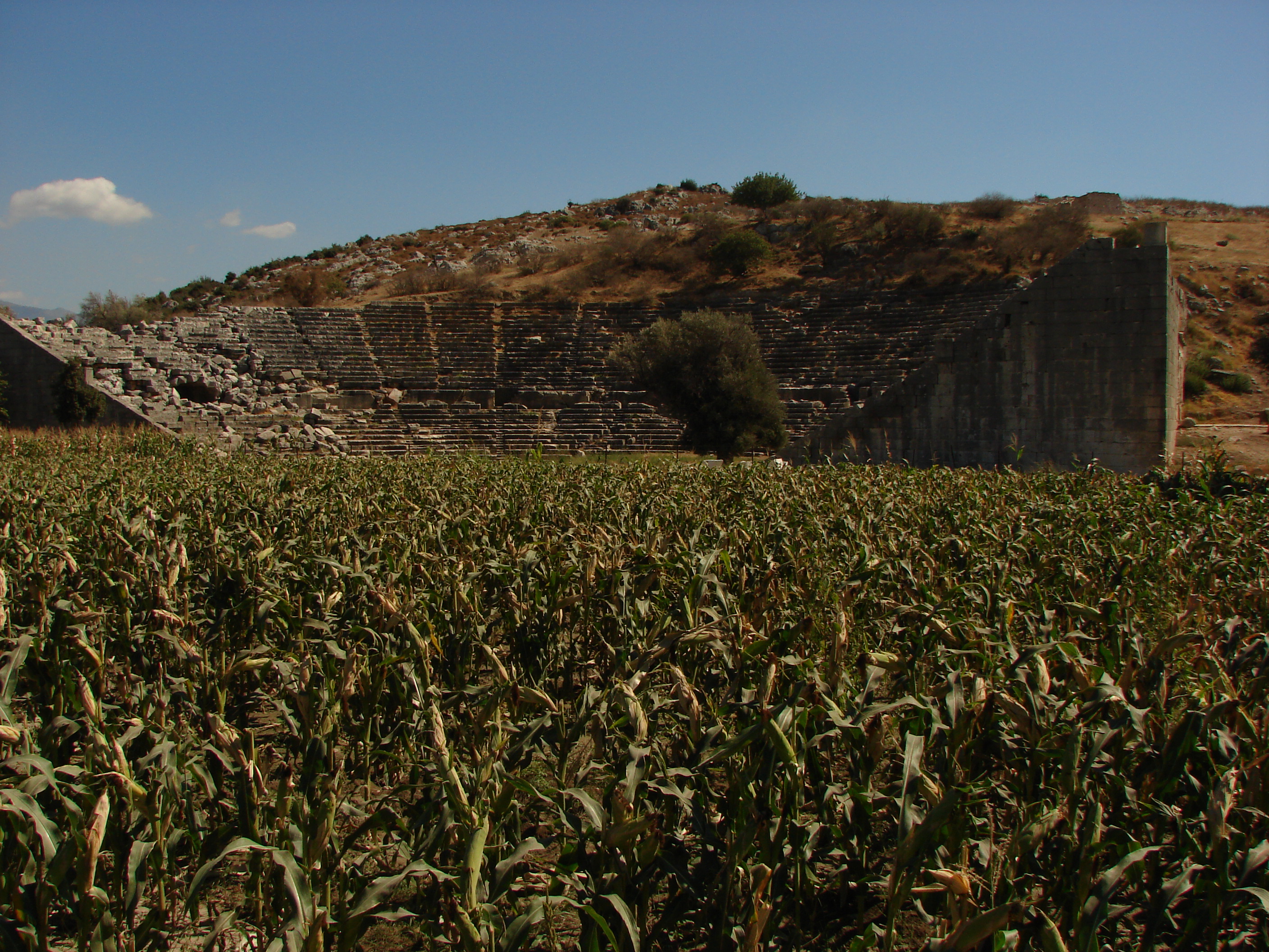
Xanthos2.jpg
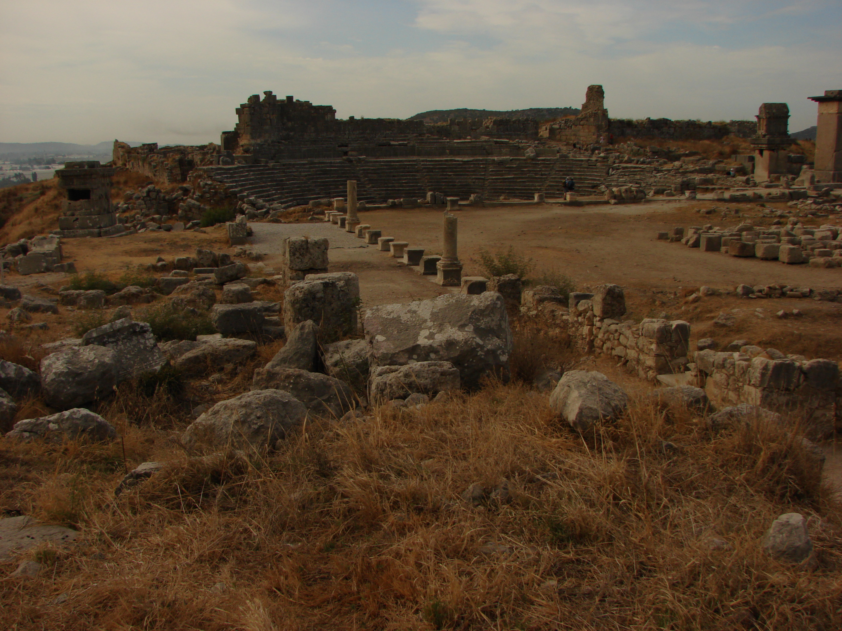
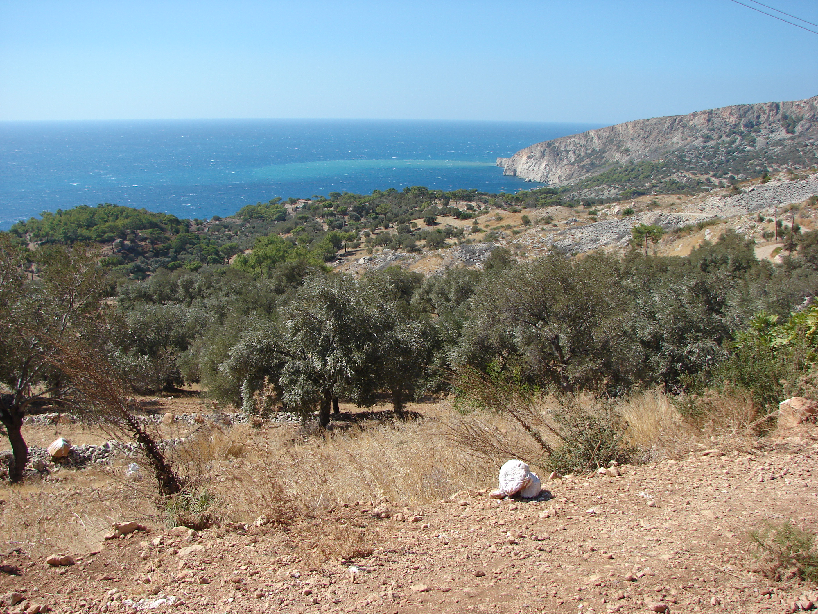
Xanthos_aqueduct1.jpg
the path beyond Cavdir follows
the remains of the Xanthos water
supply system for several miles
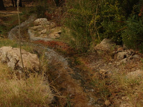
Xanthos_aqueduct2.jpg
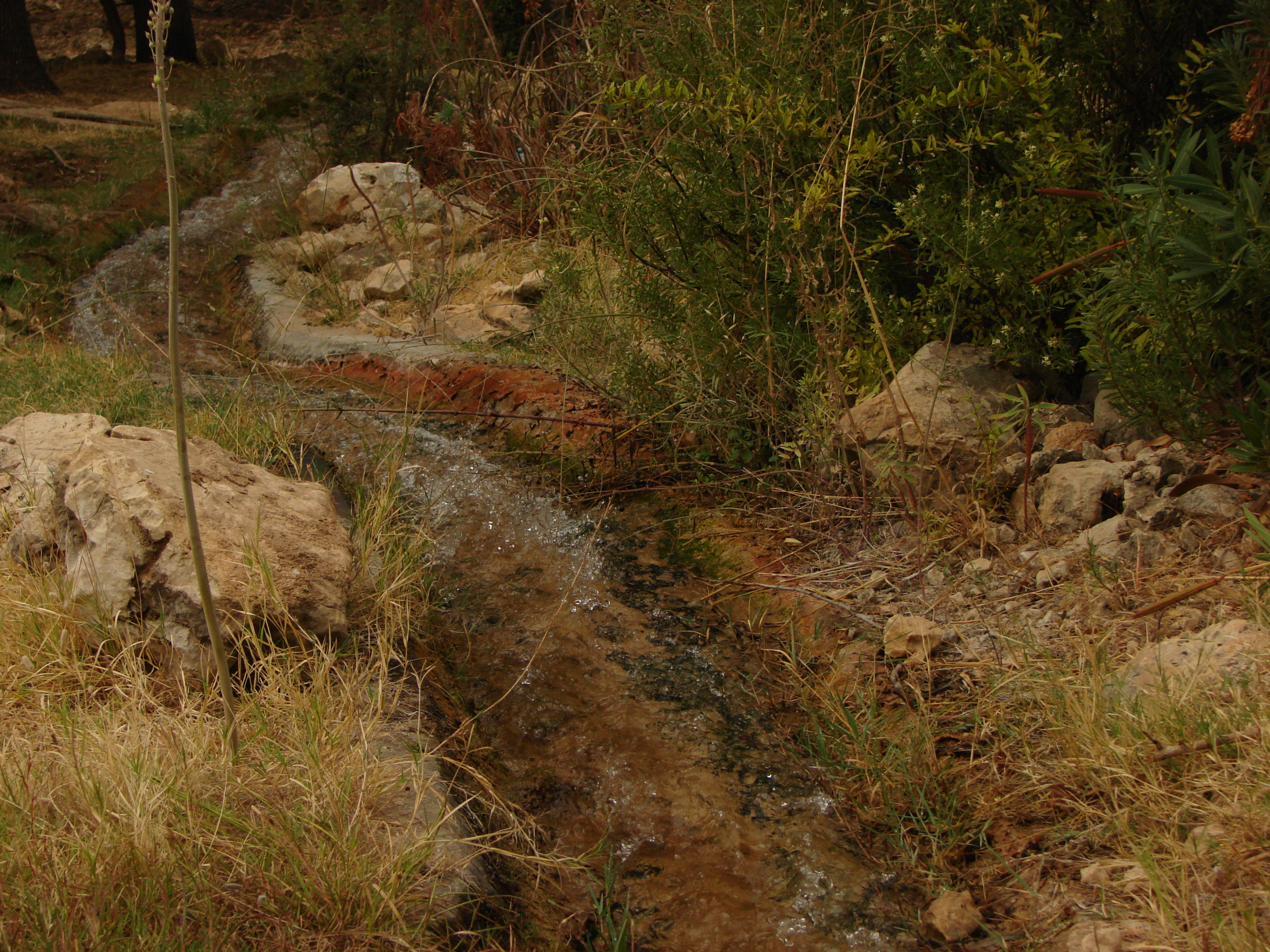
beyond Caykoy, the aqueduct is still
in use - by humans and frogs!

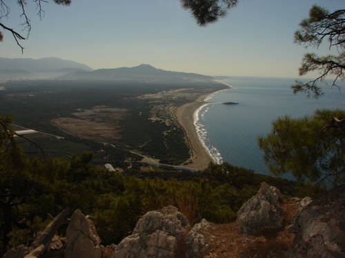
YaliBurun1.jpg
the pass above Patara, looking
towards the Kalkan bay
YaliBurun2.jpg
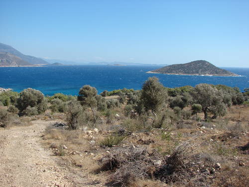
YaliBurun3.jpg
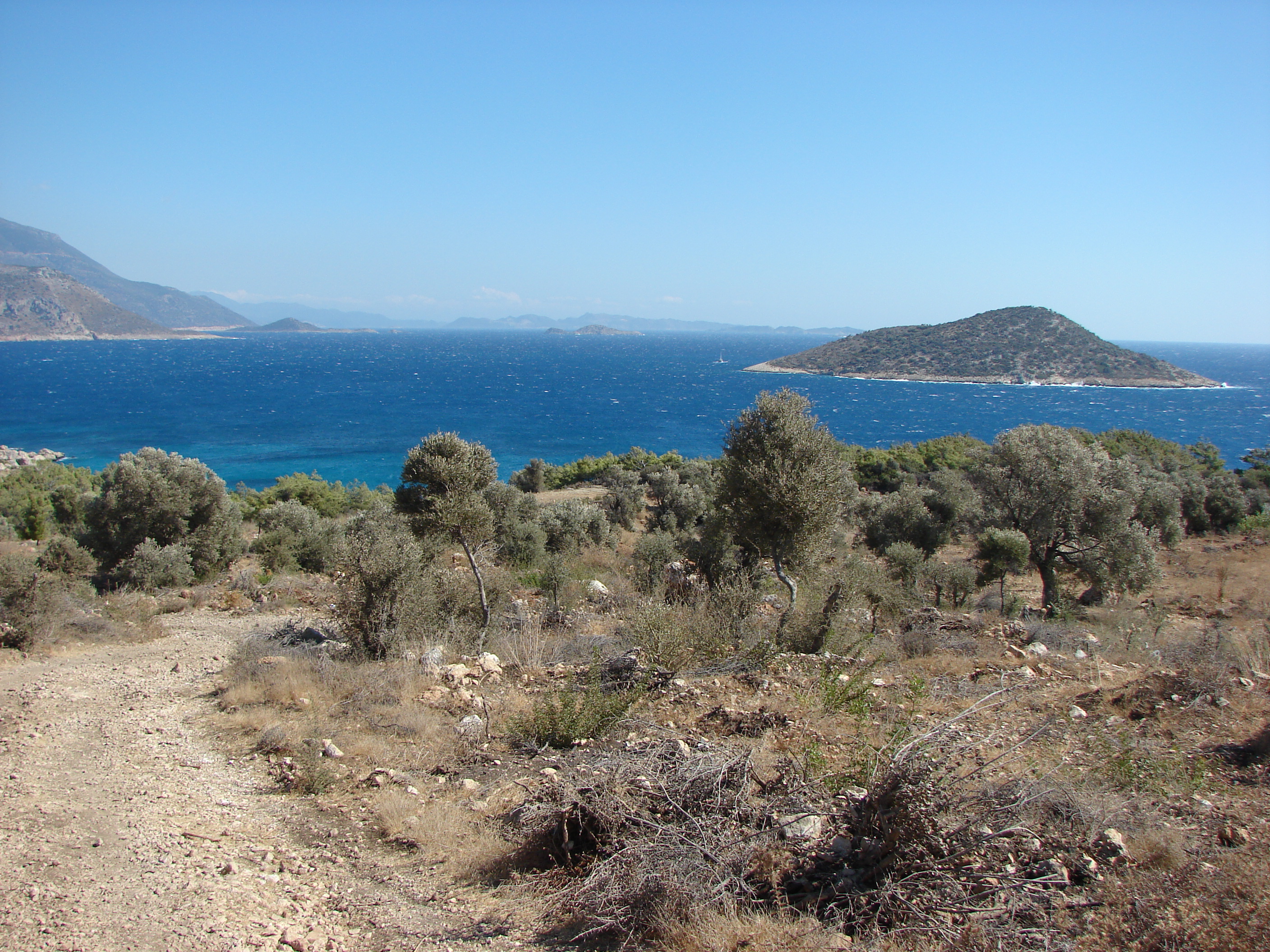
one of the islets in the Kalkan
bay seen from the penisula
east of Patara